Posts Tagged With: travel

Walking back into Sneinton

I’ve been back on the wandering trail again.

After spending much of the last few weeks walking around places that formed the backdrop to my childhood, I decided to head into Sneinton. The route would take me through the streets towards Colwick Country Park, loop around near Colwick Hall, hopacross into Bakersfield and then take me through the now increasingly familiar Colwick woods before eventually depositing me back in Sneinton again.

Sneinton is an interesting place to revisit because, growing up in Nottingham, it was one of those areas that came with a certain ‘reputation’.

Nottingham has several of them – although some have names that are frankly guilty of false advertising. To the unwary visitor, The Meadows sounds delightful. St Ann’s could be the quiet cloisters of an Oxbridge college. Forest Fields or Hyson Green evoque imagery of idyllic greenery, and Bestwood could probably be marketed as an exclusive new housing development without changing the name.

Sneinton, on the other hand, always sounded exactly like it appeared.

Particularly when pronounced properly. Not Sneen-ton like your sat nav might say, or somebody encountering the name for the first time might reasonably attempt, but Snenton. Preferably delivered quickly and in a Nottingham accent.

As kid in the 1980s I remember it as a slightly run-down inner-city area of Victorian terraces with a substantial Asian community, the sort of place that felt busy and slightly chaotic without necessarily being somewhere you’d choose to visit unless you had a reason.

We did have a reason.

For several years my brother and I attended Nottingham Olympic Judo Club on St. Stephen’s Road, under the watchful eyes of our senseis John Mewett and Dave Lawrence. Consequently Sneinton became somewhere we visited regularly, Mum dutifully taking us on Saturdays, although my mental map of it was probably little more than the journey there, the dojo itself and whatever I happened to notice through the car window along the way.

Walking down St. Stephen’s Road again, I deliberately went looking for it. It’s flats now.

There’s something oddly disconcerting about discovering that a building which occupies a perfectly solid place in your memory has simply ceased to perform the function you assigned to it. Somewhere behind those windows somebody might now go to bed in the spot where I first mastered tsuri goshi, or might take a leisurely dump where at birthday parties hosted there we’d abuse the giant inflatables to embark on ‘moonrides’ – nearly putting some of the smaller guests through the ceiling at one point!

The street itself immediately triggered another memory though. The faces.

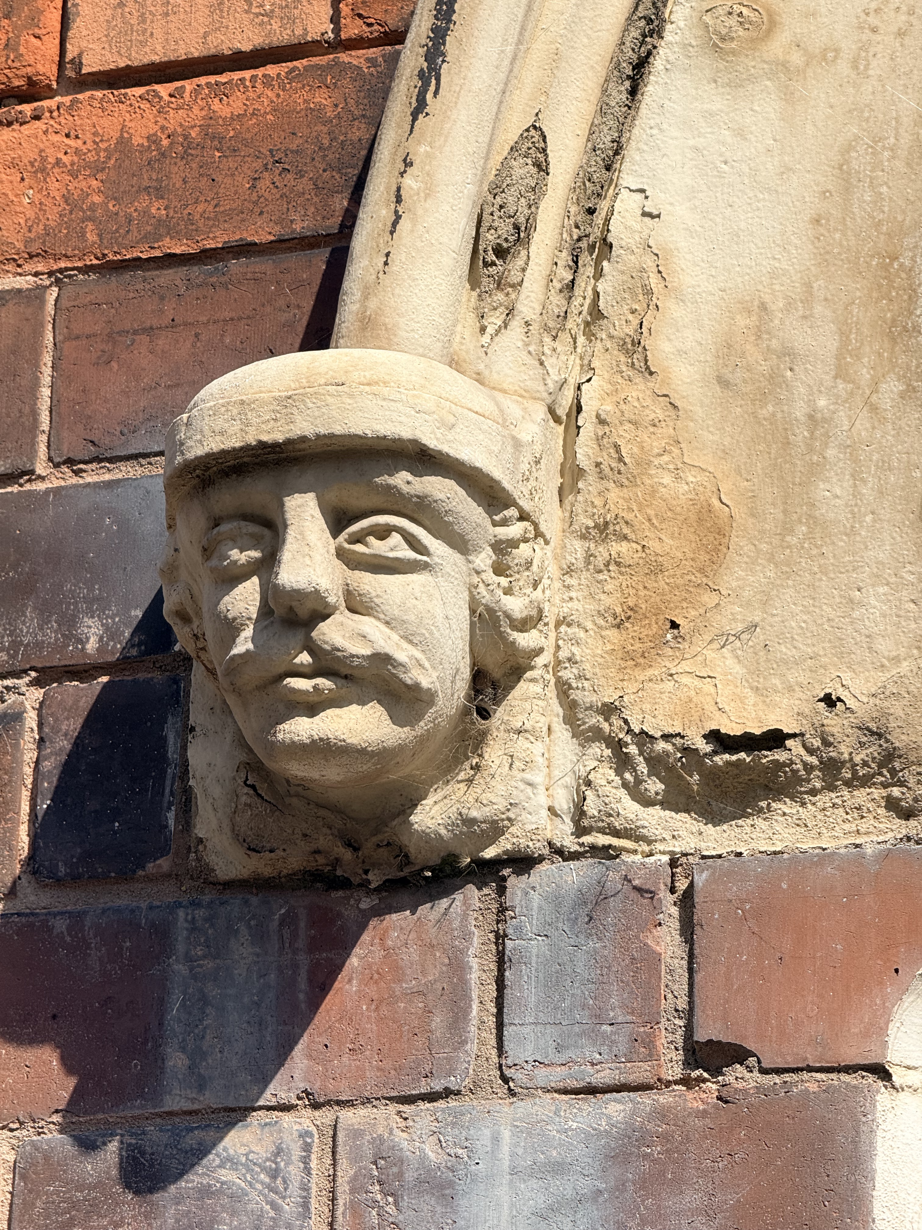
As a child I’d noticed many of the houses around here had human faces staring out from the stonework. They’re still there. Stern-looking carved heads tucked beneath the decorative stonework around front doors, apparently watching generations of Sneintonians go about their daily business.

I always wondered who they were. Kings? Local dignitaries? The people who built the houses? Particularly unfortunate former residents who had annoyed the architect?

It turns out I’m far from the first person to notice them. Sneinton has quite a collection of these carved heads and St. Stephen’s Road is apparently particularly well endowed with them. Some look vaguely like ancient warriors, others like rather severe Victorian interpretations of people from the past, but as far as I can establish there isn’t a neat answer to the question that occupied the younger me.

They’re just… faces.

Which is simultaneously disappointing and rather wonderful. They’ve probably been staring at children walking past whilst wondering who they were for considerably longer than I’ve been alive.

Sneinton itself looked surprisingly familiar too.

The Victorian streets remain. It still feels densely packed and bustling and proudly multicultural. The Asian community I remember from childhood is still very evident, particularly the Pakistani influence, but there are now Eastern European shops and businesses mixed amongst it too. Languages and people have changed while the streets containing them largely haven’t.

That’s perhaps what I found most interesting. Sneinton hasn’t really become somewhere else. It’s simply accumulated more Sneinton.

That isn’t to say nothing has changed. Slightly off my walking route is Sneinton Market, which has undergone a transformation that would have seemed utterly implausible to the younger me. Today it’s a fashionable little enclave of independent businesses, food, drink and creative spaces. This is emphatically not the Sneinton Market I remember.

My Sneinton Market was somewhere you went to buy something electrical for 99p while accepting there was a reasonable possibility it might stop being electrical before you got it home. For some reason I have a particularly vivid memory of headphones with orange foam earpieces. They were cheap, probably sounded dreadful and presumably survived until approximately Wednesday.

Nobody was drinking artisan coffee whilst I was buying them.
The funny thing about walking Sneinton today, though, is just how quickly the city starts to disappear.

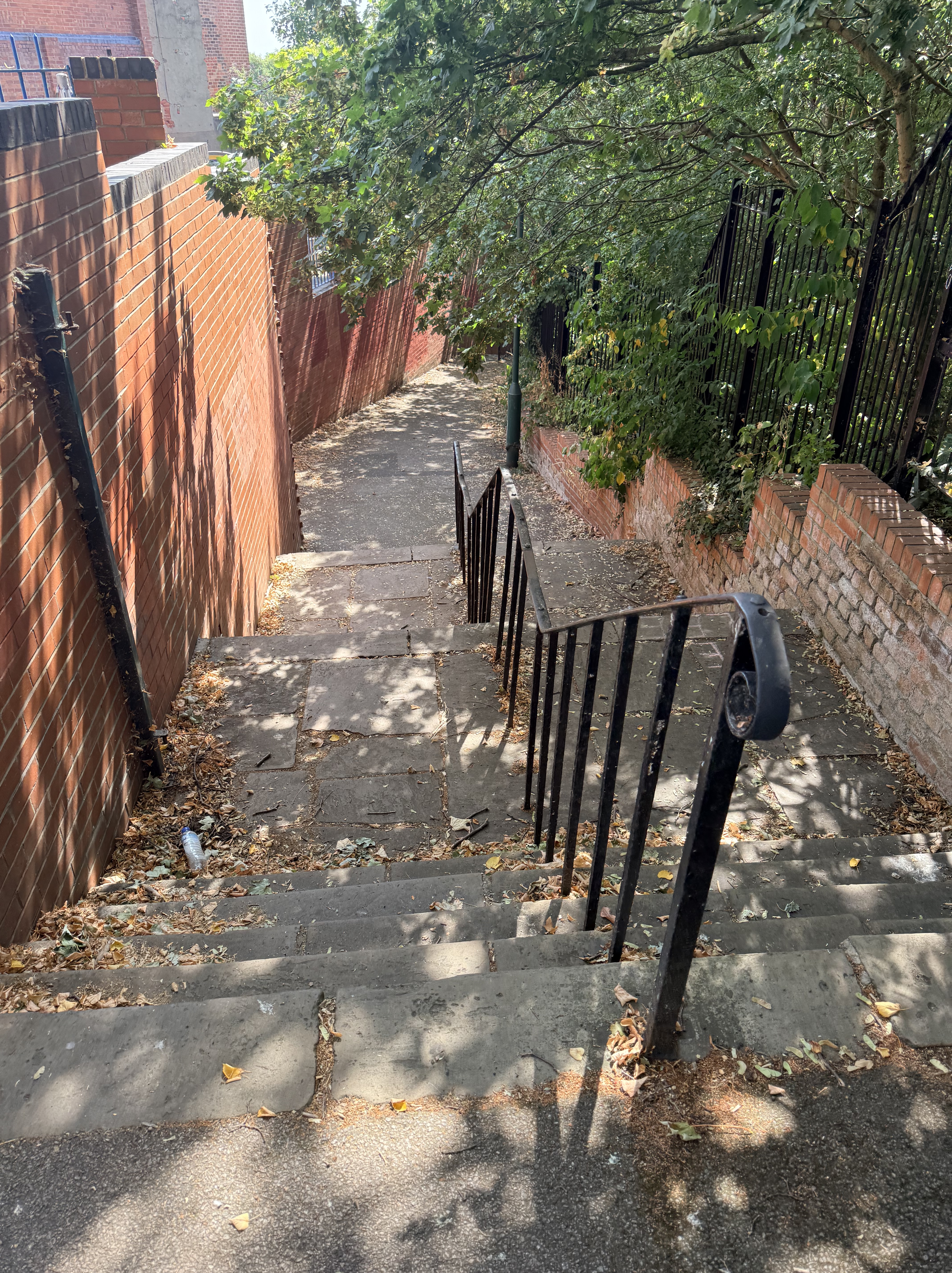
Heading along the green route eastwards, tightly packed streets give way to twitchels and finally more open space and tree-lined footpaths until suddenly you’re in Colwick Country Park. It’s remarkably easy to forget how close the Trent Valley and all that greenery are to this part of inner Nottingham.

The park itself is comparatively young. It opened in the late 1970s after former gravel workings were landscaped, but the land you’re walking through has a much longer history. The wider estate around Colwick Hall stretches back centuries, and this was parkland long before anyone thought of creating a country park. That might explain one of the things I stumbled across.

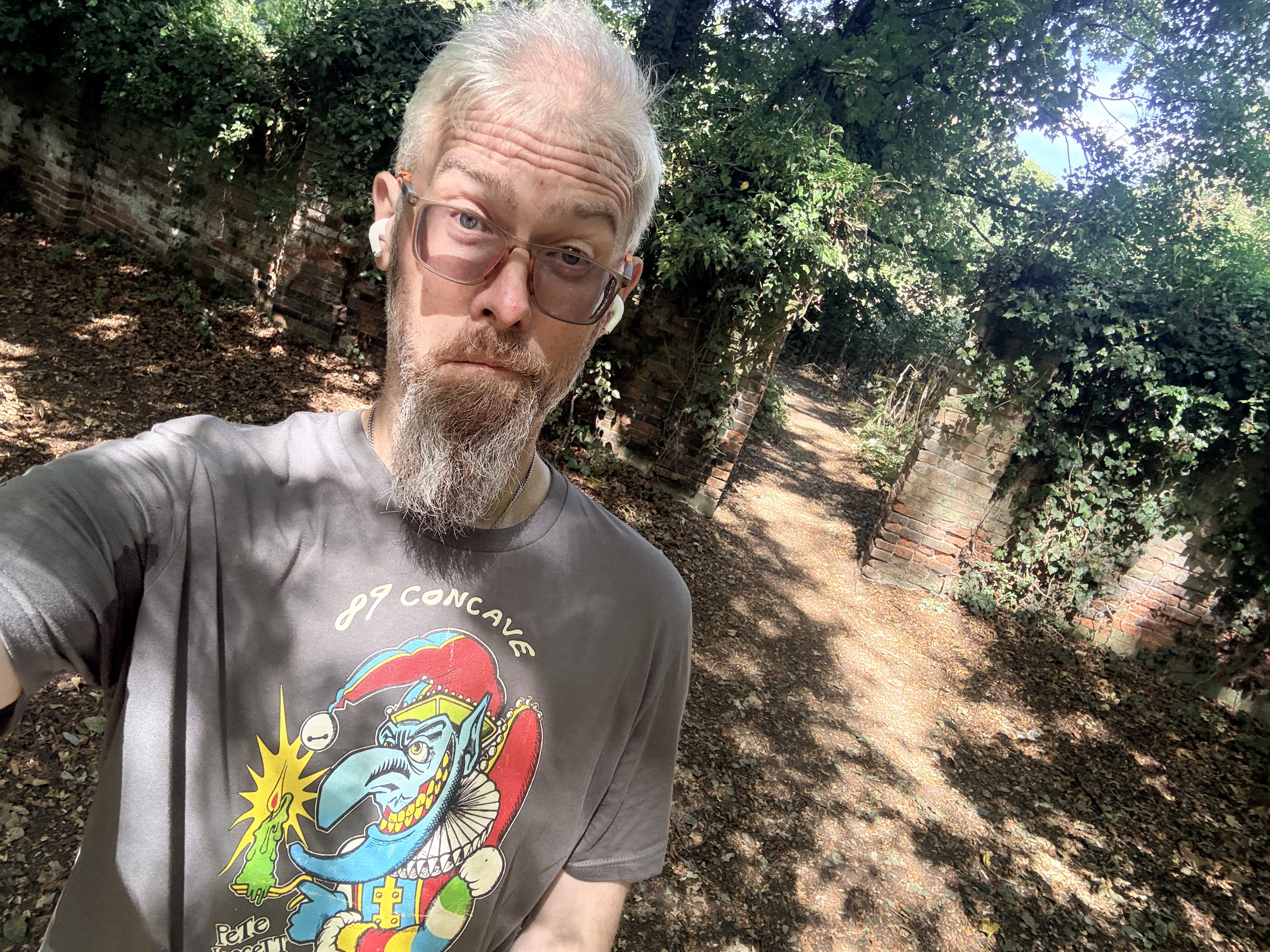
In amongst the trees I found an old brick wall, smothered in ivy and pierced by what looks very much like a former gateway. There’s no grand building immediately behind it, no helpful plaque explaining what it once enclosed and nothing obvious to tell the passing walker why it’s there at all.

Naturally, I love this. Abandoned things and mystery. That’s very much my jam!

I don’t know exactly what it is. Given the history of the surrounding land, it may be a surviving fragment associated with the old Colwick Hall estate, but for now I’d rather leave a question mark beside it than manufacture a history simply because it would be convenient to have one. Sometimes finding something you can’t immediately explain is half the fun of wandering.
More annoyingly, I also discovered afterwards I’d walked agonisingly close to the abandoned St. John the Baptist church near Colwick Hall without realising it was there. Had I known, there is absolutely no possibility I’d have walked past it – that one is going onto the list for another day.

From Colwick Park my route eventually carried me over towards Bakersfield and back through Colwick Woods, somewhere I’ve already written about. This time the woods weren’t the destination, they were simply somewhere I happened to pass through on the way back to the car. Oddly, I quite liked that.

Having recently spent a chunk of time trogging around them for childhood memories, this time I could just walk through them again. They’d returned to being part of the landscape rather than a historical exhibit I’d constructed in my own head.

Then, eventually, Sneinton swallowed me again.

There was one more familiar landmark waiting near the end of the walk, although at the moment you’d be forgiven for not immediately recognising it.

Green’s Windmill is currently swaddled in white sheeting while maintenance work takes place, looking less like one of Nottingham’s most distinctive landmarks and more like somebody has put an enormous bag over it. Underneath all that material, though, is another place that reaches straight back into my childhood.

The windmill was another memorable if not regular haunt.

As children, of course, it was simply the windmill. Somewhere Mum or Dad could take us, somewhere you could look inside, look at the scientific exhibits in the museum or – more likely – decamp to the children’s play area and burn off excess energy. Only later do you discover that the place has a rather more remarkable story.

The original tower mill was built by George Green Sr in the early nineteenth century, and his son George worked there before becoming one of Nottingham’s more unlikely contributors to the history of science. With relatively little formal education, Green produced mathematical work on electricity and magnetism that was largely overlooked during his lifetime but would eventually become enormously influential. Today Green’s theorem and Green’s functions carry the name of a Nottingham miller’s son around the world.

Which makes the fact that I basically knew the place as somewhere that was fun to play with plasma balls or on the playground perhaps more than a little ignorant!

So next time you’re tempted to think disparaging thoughts about Sneinton, remember that one of the most important mathematical physicists of the nineteenth century emerged not from some grand academic institution, but from a miller’s family on a Nottingham hillside.

After the Greens, their mill had a rather eventful afterlife: falling out of use, losing its sails, suffering a fire and spending decades as an abandoned shell before being restored and reopened in the 1980s. Which isn’t far off when I first encountered it.

Perhaps that’s the thing I hadn’t appreciated about Sneinton when I was younger. I knew it as somewhere slightly rough around the edges where we went to judo. I knew the terraces, the Asian shops, the market selling questionably inexpensive electrical goods, the windmill on the hill and those mysterious stone faces staring down from the houses.

I hadn’t really noticed how many different landscapes and stories were squeezed together around it.

Within one walk I’d passed Victorian terraces, the ghosts of my old judo club, Pakistani and Eastern European shops, a country park, mysterious estate walls, lakes, the edge of an old country house, ancient woodland and the temporarily bagged up remains of a windmill that once belonged to a largely self-taught mathematical genius.

And yet somehow it all fits together.

As a kid I used to joke that Sneinton (Snenton, remember) sounded exactly like what it was. Walking around it again all these years later, I’m not entirely sure what I thought that meant. It’s untidy in places, of course. But it’s also colourful, busy, old, multicultural. Occasionally it’s beautiful, and occasionally perhaps lacking a bit of care. It has changed enormously in some ways, and hardly at all in others.

Perhaps the little stone faces opposite the old dojo on St. Stephen’s Road understand it better than I do.

They were there when I walked past them as a boy on my way to judo. The windmill was up on the hill. They’re both still there now, while the dojo has become flats, the market has discovered artisan food, new communities have arrived and I’ve somehow become the middle-aged bloke wandering around taking photographs of all of it.

I still don’t know who the faces are supposed to be.

But I do rather like the fact they’re still watching.
Categories: Blog, Exploring | Tags: , , , , , , , , , , , | Leave a comment

Walking through the Lagoons..

Over the last week I’ve found myself doing a lot of wandering. I think it’s time well spent when I have a few days off work. One walk leads to another, and before long you’ve found yourself revisiting places you haven’t properly thought about for decades.

Yesterday’s walk began somewhere that was familiar long before I reached the footpath.

I parked on Godfrey Street in Netherfield, outside the first house I ever bought. It’s funny how ordinary somewhere can look once enough years have passed. At the time it represented everything that came with finally becoming an adult: my first mortgage, decorating rooms that were suddenly my responsibility, discovering just how many things can unexpectedly break when you own a house. Standing there yesterday it was simply another terraced street with cars lining the kerb. If I hadn’t lived there, I’d probably have driven straight past without giving it a second thought.

From there I wandered down towards Netherfield Lagoons.

If you’ve never visited, it’s a remarkably peaceful place. Reeds sway gently beside the paths, dragonflies dart over the water and birds seem to outnumber people. It’s difficult to imagine that this landscape was once anything else.

Yet that’s not how I remember it.

As children, Dad would occasionally bring Rich and me here armed with an air rifle and a pocketful of pellets. We weren’t hunting anything more exciting than tin cans balanced on old banks or tucked safely into whatever earthworks we could find. My memories are hazy now, but I remember rough ground, overgrown ditches and a landscape that felt forgotten rather than protected. There were railway lines too, active ones from memory, where crossing points seemed rather more casual than modern health and safety would ever tolerate.

Perhaps memory has exaggerated some of that. Perhaps I simply didn’t quite find the same corner yesterday. Either way, I found almost none of the landscape I remembered.

Instead there were butterflies drifting across wildflowers, birdsong replacing the metallic soundtrack I’d half expected, and cyclists, dog-walkers and birdwatchers quietly enjoying somewhere that has become one of Nottinghamshire’s loveliest nature reserves.

Walking beyond the lagoons and alongside the River Trent brought back another memory.

I remember meeting my uncle here while he was fishing. I couldn’t tell you whether he caught anything that day. I can’t remember what we talked about. I simply remember him sitting there, rod in hand, as though he’d always belonged beside the river. Funny how memory works like that. It often remembers the person far more clearly than the event itself.

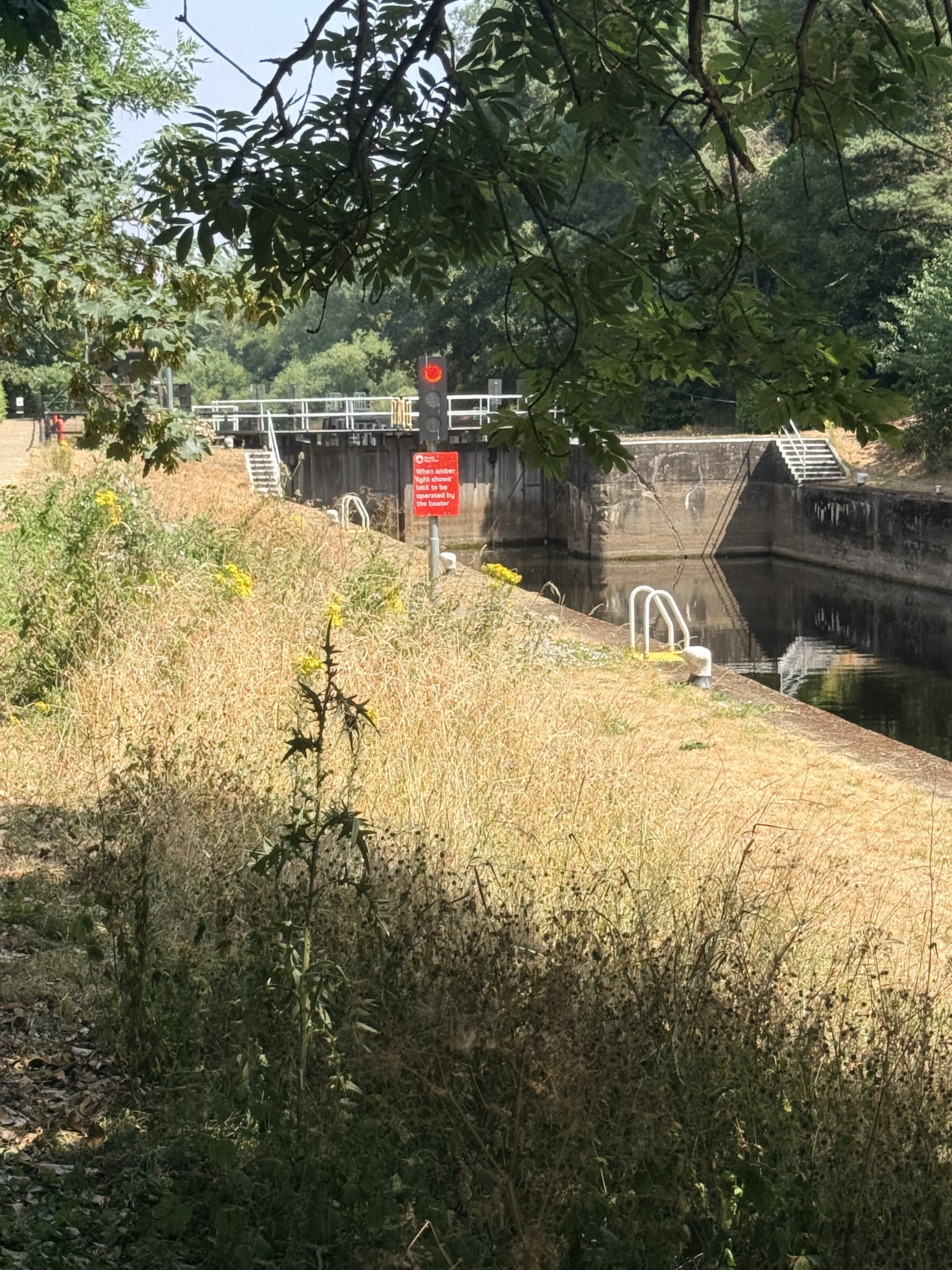
A little further downstream I reached Trent Lock, where the river briefly divides around the weir before boats continue their journey through the lock. It’s one of those pieces of engineering that quietly does its job without demanding much attention.

No boats were using the lock whilst I was there – which probably spared me from reliving a somewhat traumatic canal boat holiday from childhood. That’s perhaps a story for another day.

Leaving the river, the footpath heads back across the fields as you reach the village of Stoke Bardolph.

Most people know Stoke Bardolph for its water treatment works. As children, however, we had a rather less sophisticated name for it.

It was simply “the shit farm.”

Dad would occasionally bring us here too, where we’d stand at what seemed a perfectly acceptable distance throwing stones into what I now know was sewage slurry. Looking back, I’m amazed we were ever allowed anywhere near the place. Today, mature trees screen much of the works from view and modern security makes wandering up to the edge completely impossible.

It’s probably for the best.

Some childhood adventures are best left in childhood.

The more I walked, the more I realised how thoroughly this landscape has reinvented itself. The lagoons themselves exist because people reshaped the floodplain. Gravel was dug here, railway sidings once spread across the area, and later the settling lagoons received coal slurry pumped back from nearby Gedling Colliery after the coal had been washed. It was a working landscape, built to serve industry rather than wildlife.

Now, nature has quietly reclaimed almost all of it. That’s the most remarkable transformation of all: a landscape once shaped entirely by industry now feels as though nature was always in charge.

It’s remarkable how completely it has succeeded. Standing among the reeds, it’s difficult to picture excavators, freight wagons or industrial settling ponds. If you didn’t know the history, you’d assume the birds had always been here.

As I looped back towards Godfrey Street, it struck me that I’d spent much of the afternoon searching for places that no longer really exist.

The rough ground where we balanced tin cans has disappeared beneath grass and wildflowers. The industrial landscape has softened into wetlands. Even the sewage works has hidden itself behind a curtain of mature trees.

Yet somehow the memories remain perfectly intact.

Perhaps that’s what these walks have really been about.

Not finding places exactly as they were, because they often aren’t – although not every landscape changes so dramatically. Lambley Dumbles and Colwick Woods still feel remarkably close to the places I remember growing up.

Places evolve, just as we do. Industries close. Nature returns. Houses change hands. Children grow older.

What stays with us isn’t the landscape itself but the moments we borrowed from it.

Categories: Blog | Tags: , , , , , , , , | Leave a comment

Time Travelling through Lambley Dumbles..

I’m not sure how long I’ll try to milk this particular cow, but as I’ve a few days off work this week and the weather is lovely I decided to reacquaint myself with an old childhood haunt, and with time travelling in mind, it naturally flowed!

Unlike Woodville Tollgate, this one doesn’t involve sitting in traffic. Instead, it begins with a walk through Lambley Dumbles, following the winding paths beside Cocker Beck.

This isn’t somewhere I’ve recently discovered. Quite the opposite.

I grew up in Mapperley and Gedling, and long before I developed an interest in history, archaeology or place names, I spent countless hours exploring these woods and fields. Back then it was simply somewhere to escape. Somewhere to paddle in the beck, scramble over fallen trees, get thoroughly muddy and latterly as a younger adult possibly reward myself with a pint at The Lambley.

As children, we don’t really think about history. We just accept places as they’ve always been.

Only much later did it occur to me that I’d spent my childhood wandering through a landscape that was already ancient before the first human being ever set foot there.

So, let’s wind the clock backwards.

The oldest thing on the walk

The first surprise is that the Dumbles themselves are almost certainly the oldest thing you’ll encounter.

Not the church, not the village, not even Cocker Beck, the valley itself.

Go back around ten thousand years to the end of the last Ice Age and Britain is emerging from a world of glaciers, meltwater and dramatic environmental change. Vast quantities of water carved deep channels through the soft Mercia Mudstone beneath what is now Nottinghamshire, creating the steep-sided wooded valleys we know today as dumbles.

Which is pretty crazy to think about really.

As children we ran through them without a second thought. We probably saw them as nothing more than somewhere steep enough to slide down and difficult enough to climb back out of again.

In reality, they are among the oldest features in the entire landscape.

A word that belongs here

One thing I’ve always loved about local history is discovering words that only seem to exist because local people needed them.

“Dumble” is one of those words.

Elsewhere people might call them ravines, gullies or wooded valleys, but none of those quite capture what a dumble is. Here in the East Midlands, everyone simply seems to understand the word instinctively.

I rather like that.

Sometimes language survives not because scholars preserve it, but because ordinary people never found a better word.

The beck that shaped everything

As I walked beside Cocker Beck this week, something struck me. It’s tempting to think the stream runs through Lambley. In reality, Lambley exists because of the stream.

Long before anyone built houses, churches or footpaths, the beck had already found the easiest route through the landscape. Those same routes later became tracks, and eventually roads. Even today, the oldest parts of the village still follow the water.

The village didn’t tell Cocker Beck where to flow. Cocker Beck quietly told the village where to be. Once that thought occurred to me, it became impossible to unsee.

Before there was England

Keep travelling backwards.

Long before there was Nottinghamshire, before there was Mercia, before there was England, this landscape was peopled by Brythonic-speaking Britons, members of clans we’ve subsequently named but have no idea what they called themselves or how they even thought about themselves.

There were no counties. No churches. No villages.

Just woodland, streams and probably scattered hunter-gatherers, and later the first farming communities.

Rome arrives… and almost passes by

When the Romans invaded Britain in AD 43 they transformed much of the country.

Curiously, Lambley Dumbles seems to have escaped much of that transformation.

Roman roads passed nearby, connecting settlements at modern-day Derby, Leicester and Lincoln, but the valley itself probably changed remarkably little. If you stood beside Cocker Beck around AD 200, you might occasionally encounter travellers heading towards those roads, but otherwise the view would probably have felt surprisingly familiar.

The Romans stayed for nearly four centuries. The Dumbles simply carried on being Dumbles.

The village arrives

Eventually, people began settling permanently around the streams.

By the time of the Domesday Book in 1086, Lambley was already an established village. Its name probably derives from an Old English phrase meaning something like “the clearing where lambs grazed.”

Like Wooden Box in my last article, it’s another reminder that our ancestors generally named places for what they were rather than what they wished they were.

Kingdoms come and go

Beyond the valley, history refused to stand still. Mercian kings ruled from nearby Repton. Viking armies marched across Nottinghamshire. The Danelaw began and receded, the Normans arrived and reshaped England.

And yet I can’t help wondering how much of that would have been obvious if you’d simply stood beside Cocker Beck.

The water would still have flowed over the same stones, the trees would still have filled the valley with birdsong, the seasons would still have turned exactly as they always had.

Some places seem to absorb history, others simply watch it unfold, immovable.

Looking through time

Walking through Lambley Dumbles this week, I realised I probably enjoyed it just now as a child.

The difference is that I was looking at something completely different, back then I saw mud, trees and a stream, now I see the end of the Ice Age. I see prehistoric hunters following the water. I see Brythonic farmers, Roman travellers, Saxon settlers and medieval villagers all walking the same valley. The people changed, the languages changed, the kingdoms changed.

But the Dumbles remained exactly where the melting ice left them ten thousand years ago.

Perhaps that’s why this place has always felt different to me.

Not because it’s untouched by history, but because it’s older than almost all of it.

The next time I find myself following Cocker Beck beneath the trees, I doubt I’ll be thinking about my step count, I’ll probably be wondering whether ten-year-old me ever imagined that one day I’d realise the oldest thing in Lambley wasn’t the village, or the church, or even the beck.

It was the valley itself.

Categories: Blog | Tags: , , , , , , , , , | 1 Comment

Blog at WordPress.com.