Exploring

Ramblings relating to a recent tendency I seem to have developed to go out exploring places!

Walking back into Sneinton

I’ve been back on the wandering trail again.

After spending much of the last few weeks walking around places that formed the backdrop to my childhood, I decided to head into Sneinton. The route would take me through the streets towards Colwick Country Park, loop around near Colwick Hall, hopacross into Bakersfield and then take me through the now increasingly familiar Colwick woods before eventually depositing me back in Sneinton again.

Sneinton is an interesting place to revisit because, growing up in Nottingham, it was one of those areas that came with a certain ‘reputation’.

Nottingham has several of them – although some have names that are frankly guilty of false advertising. To the unwary visitor, The Meadows sounds delightful. St Ann’s could be the quiet cloisters of an Oxbridge college. Forest Fields or Hyson Green evoque imagery of idyllic greenery, and Bestwood could probably be marketed as an exclusive new housing development without changing the name.

Sneinton, on the other hand, always sounded exactly like it appeared.

Particularly when pronounced properly. Not Sneen-ton like your sat nav might say, or somebody encountering the name for the first time might reasonably attempt, but Snenton. Preferably delivered quickly and in a Nottingham accent.

As kid in the 1980s I remember it as a slightly run-down inner-city area of Victorian terraces with a substantial Asian community, the sort of place that felt busy and slightly chaotic without necessarily being somewhere you’d choose to visit unless you had a reason.

We did have a reason.

For several years my brother and I attended Nottingham Olympic Judo Club on St. Stephen’s Road, under the watchful eyes of our senseis John Mewett and Dave Lawrence. Consequently Sneinton became somewhere we visited regularly, Mum dutifully taking us on Saturdays, although my mental map of it was probably little more than the journey there, the dojo itself and whatever I happened to notice through the car window along the way.

Walking down St. Stephen’s Road again, I deliberately went looking for it. It’s flats now.

There’s something oddly disconcerting about discovering that a building which occupies a perfectly solid place in your memory has simply ceased to perform the function you assigned to it. Somewhere behind those windows somebody might now go to bed in the spot where I first mastered tsuri goshi, or might take a leisurely dump where at birthday parties hosted there we’d abuse the giant inflatables to embark on ‘moonrides’ – nearly putting some of the smaller guests through the ceiling at one point!

The street itself immediately triggered another memory though. The faces.

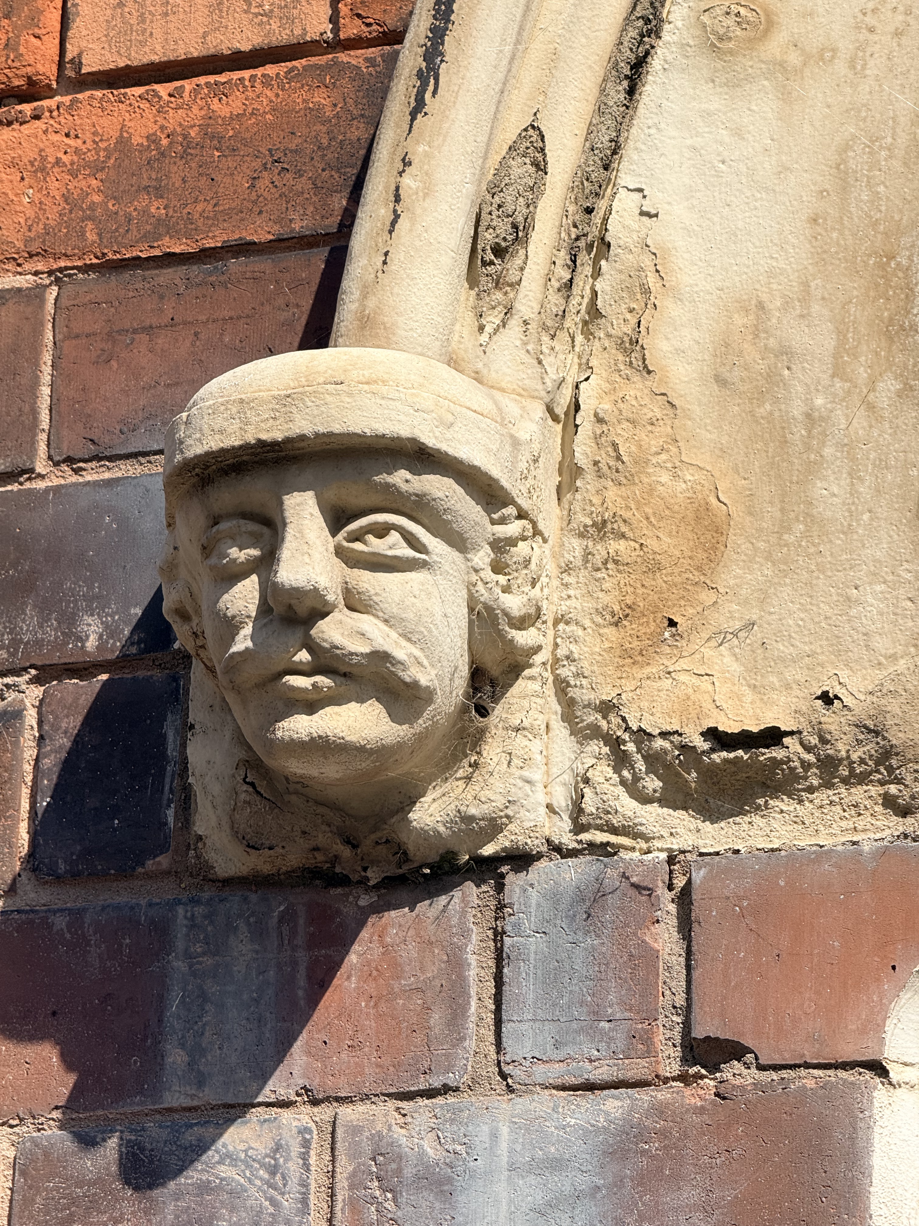
As a child I’d noticed many of the houses around here had human faces staring out from the stonework. They’re still there. Stern-looking carved heads tucked beneath the decorative stonework around front doors, apparently watching generations of Sneintonians go about their daily business.

I always wondered who they were. Kings? Local dignitaries? The people who built the houses? Particularly unfortunate former residents who had annoyed the architect?

It turns out I’m far from the first person to notice them. Sneinton has quite a collection of these carved heads and St. Stephen’s Road is apparently particularly well endowed with them. Some look vaguely like ancient warriors, others like rather severe Victorian interpretations of people from the past, but as far as I can establish there isn’t a neat answer to the question that occupied the younger me.

They’re just… faces.

Which is simultaneously disappointing and rather wonderful. They’ve probably been staring at children walking past whilst wondering who they were for considerably longer than I’ve been alive.

Sneinton itself looked surprisingly familiar too.

The Victorian streets remain. It still feels densely packed and bustling and proudly multicultural. The Asian community I remember from childhood is still very evident, particularly the Pakistani influence, but there are now Eastern European shops and businesses mixed amongst it too. Languages and people have changed while the streets containing them largely haven’t.

That’s perhaps what I found most interesting. Sneinton hasn’t really become somewhere else. It’s simply accumulated more Sneinton.

That isn’t to say nothing has changed. Slightly off my walking route is Sneinton Market, which has undergone a transformation that would have seemed utterly implausible to the younger me. Today it’s a fashionable little enclave of independent businesses, food, drink and creative spaces. This is emphatically not the Sneinton Market I remember.

My Sneinton Market was somewhere you went to buy something electrical for 99p while accepting there was a reasonable possibility it might stop being electrical before you got it home. For some reason I have a particularly vivid memory of headphones with orange foam earpieces. They were cheap, probably sounded dreadful and presumably survived until approximately Wednesday.

Nobody was drinking artisan coffee whilst I was buying them.
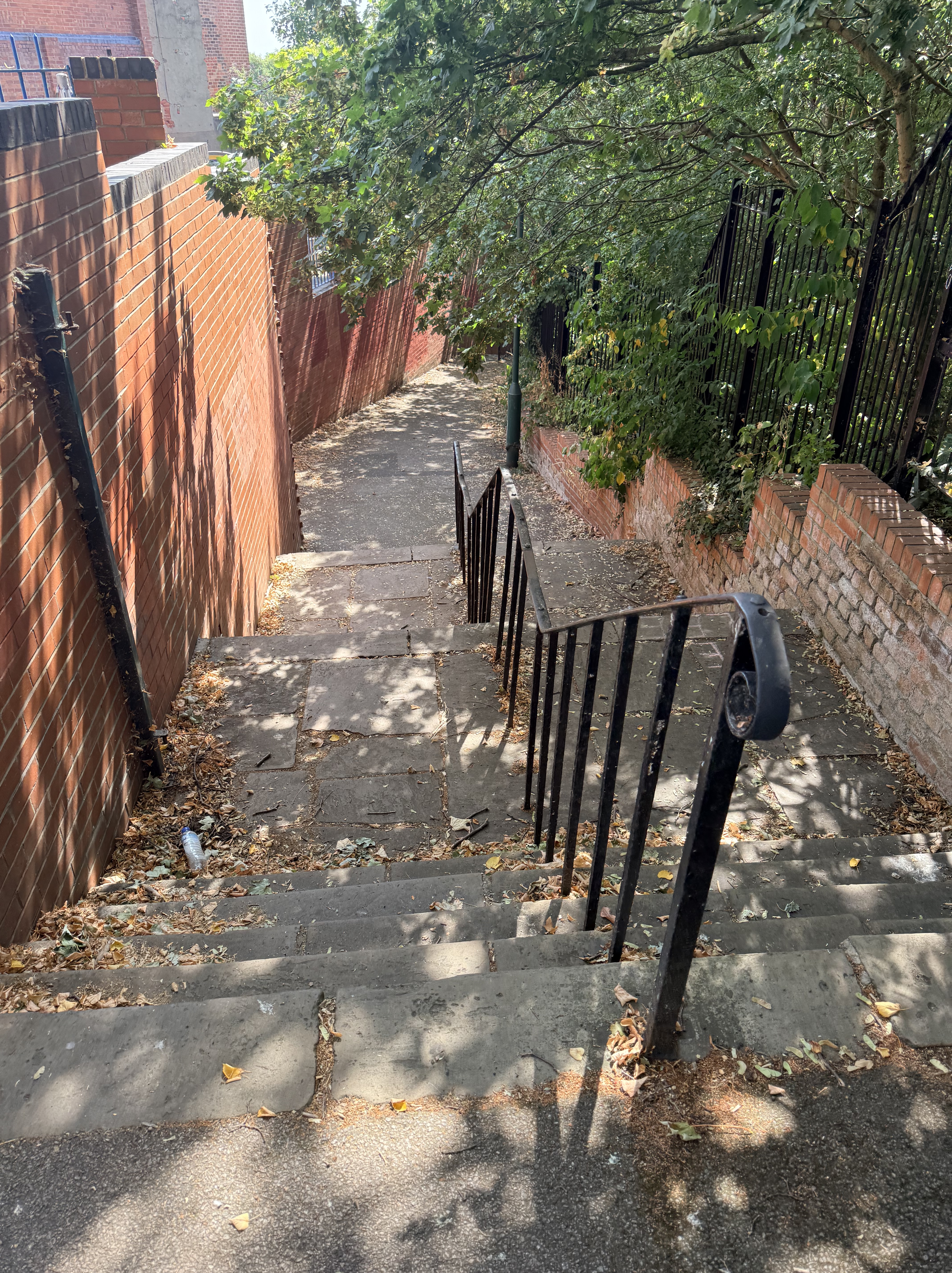
The funny thing about walking Sneinton today, though, is just how quickly the city starts to disappear.

Heading along the green route eastwards, tightly packed streets give way to twitchels and finally more open space and tree-lined footpaths until suddenly you’re in Colwick Country Park. It’s remarkably easy to forget how close the Trent Valley and all that greenery are to this part of inner Nottingham.

The park itself is comparatively young. It opened in the late 1970s after former gravel workings were landscaped, but the land you’re walking through has a much longer history. The wider estate around Colwick Hall stretches back centuries, and this was parkland long before anyone thought of creating a country park. That might explain one of the things I stumbled across.

In amongst the trees I found an old brick wall, smothered in ivy and pierced by what looks very much like a former gateway. There’s no grand building immediately behind it, no helpful plaque explaining what it once enclosed and nothing obvious to tell the passing walker why it’s there at all.

Naturally, I love this. Abandoned things and mystery. That’s very much my jam!

I don’t know exactly what it is. Given the history of the surrounding land, it may be a surviving fragment associated with the old Colwick Hall estate, but for now I’d rather leave a question mark beside it than manufacture a history simply because it would be convenient to have one. Sometimes finding something you can’t immediately explain is half the fun of wandering.
More annoyingly, I also discovered afterwards I’d walked agonisingly close to the abandoned St. John the Baptist church near Colwick Hall without realising it was there. Had I known, there is absolutely no possibility I’d have walked past it – that one is going onto the list for another day.

From Colwick Park my route eventually carried me over towards Bakersfield and back through Colwick Woods, somewhere I’ve already written about. This time the woods weren’t the destination, they were simply somewhere I happened to pass through on the way back to the car. Oddly, I quite liked that.

Having recently spent a chunk of time trogging around them for childhood memories, this time I could just walk through them again. They’d returned to being part of the landscape rather than a historical exhibit I’d constructed in my own head.

Then, eventually, Sneinton swallowed me again.

There was one more familiar landmark waiting near the end of the walk, although at the moment you’d be forgiven for not immediately recognising it.

Green’s Windmill is currently swaddled in white sheeting while maintenance work takes place, looking less like one of Nottingham’s most distinctive landmarks and more like somebody has put an enormous bag over it. Underneath all that material, though, is another place that reaches straight back into my childhood.

The windmill was another memorable if not regular haunt.

As children, of course, it was simply the windmill. Somewhere Mum or Dad could take us, somewhere you could look inside, look at the scientific exhibits in the museum or – more likely – decamp to the children’s play area and burn off excess energy. Only later do you discover that the place has a rather more remarkable story.

The original tower mill was built by George Green Sr in the early nineteenth century, and his son George worked there before becoming one of Nottingham’s more unlikely contributors to the history of science. With relatively little formal education, Green produced mathematical work on electricity and magnetism that was largely overlooked during his lifetime but would eventually become enormously influential. Today Green’s theorem and Green’s functions carry the name of a Nottingham miller’s son around the world.

Which makes the fact that I basically knew the place as somewhere that was fun to play with plasma balls or on the playground perhaps more than a little ignorant!

So next time you’re tempted to think disparaging thoughts about Sneinton, remember that one of the most important mathematical physicists of the nineteenth century emerged not from some grand academic institution, but from a miller’s family on a Nottingham hillside.

After the Greens, their mill had a rather eventful afterlife: falling out of use, losing its sails, suffering a fire and spending decades as an abandoned shell before being restored and reopened in the 1980s. Which isn’t far off when I first encountered it.

Perhaps that’s the thing I hadn’t appreciated about Sneinton when I was younger. I knew it as somewhere slightly rough around the edges where we went to judo. I knew the terraces, the Asian shops, the market selling questionably inexpensive electrical goods, the windmill on the hill and those mysterious stone faces staring down from the houses.

I hadn’t really noticed how many different landscapes and stories were squeezed together around it.

Within one walk I’d passed Victorian terraces, the ghosts of my old judo club, Pakistani and Eastern European shops, a country park, mysterious estate walls, lakes, the edge of an old country house, ancient woodland and the temporarily bagged up remains of a windmill that once belonged to a largely self-taught mathematical genius.

And yet somehow it all fits together.

As a kid I used to joke that Sneinton (Snenton, remember) sounded exactly like what it was. Walking around it again all these years later, I’m not entirely sure what I thought that meant. It’s untidy in places, of course. But it’s also colourful, busy, old, multicultural. Occasionally it’s beautiful, and occasionally perhaps lacking a bit of care. It has changed enormously in some ways, and hardly at all in others.

Perhaps the little stone faces opposite the old dojo on St. Stephen’s Road understand it better than I do.

They were there when I walked past them as a boy on my way to judo. The windmill was up on the hill. They’re both still there now, while the dojo has become flats, the market has discovered artisan food, new communities have arrived and I’ve somehow become the middle-aged bloke wandering around taking photographs of all of it.

I still don’t know who the faces are supposed to be.

But I do rather like the fact they’re still watching.
Categories: Blog, Exploring | Tags: , , , , , , , , , , , | Leave a comment

Looking for the Perfect Stick

This week I’ve been doing a lot of wandering and pondering. I think it’s time well spent when I have a few days off work. Today I found myself drawn to another place from my childhood.

I’d planned a longish walk – around five miles – that would take me from Carlton Hill, down towards Sneinton and up into Bakersfield and eventually into Colwick Woods before looping back again. Looking at the map beforehand, I realised something I’d never really considered before.

Growing up in Mapperley, then buying my first houses in Netherfield and Gedling I’d spent years quietly orbiting Carlton. Dad’s side of the family seemed to inhabit every corner of the suburb, so we were frequent visitors whether it was to see Mama on a Saturday or one of my uncles and aunties, they were all there – those still with us still are!

And right on its doorstep is Colwick Woods.

I honestly can’t recall when Dad first starting taking me and Rich there.

It feels as though they were simply always part of childhood.

The funny thing about childhood memories is that they don’t usually arrive in chronological order. They arrive in flashes. One moment I’m searching the woodland floor for the perfect stick. Not just any stick, but the sort that absolutely had to become a magnificent longbow.

As far as I can remember, none of them ever did.

Finding them always seemed to be far more important than making them. Then another memory surfaces.

Dad telling us about one of his childhood friends running full speed down a hill and straight into a tree. I’ve often wondered whether that actually happened or whether it was simply an inspired piece of parenting designed to discourage two energetic boys from doing exactly the same thing. Either way, it mostly worked.

Some memories arrive attached to people – one afternoon I think nearly back at the car I managed to disturb what was probably a wasps’ nest. I remember John, a dear family friend sadly no longer with us instantly leaping into action. At the time I simply remember him furiously swatting wasps that had dared sting me. I don’t think I ever saw John express anger before or after that event.

I don’t think he was really angry with the wasps, perhaps he was simply furious that something had hurt one of his people.

Other memories arrive attached to the sky – I clearly remember standing in the open grassland watching the Red Arrows thunder overhead. I recall it was planned. I’ve no idea where they were going, or what event they were performing at, or even how my parents knew they’d be passing overhead. None of that mattered. We simply stood there looking up.

The same hills became sledging runs when winter decided to oblige. Looking back now, they don’t seem anywhere near as steep as they once did. Perhaps hills shrink as we grow, or perhaps imagination simply makes everything bigger.

Another memory has stayed with me for decades despite never actually happening. Throughout a chunk of my childhood I had the same recurring dream.

Somehow, a travelling fair had arrived on the open grassland beside the woods. I remember winning a toy fire engine before wandering into the woodland with my friends Carl and Phil. The woods were familiar and weird all at once. The ground undulated almost like freshly ploughed earth and, somehow, the branches and shadows in the trees formed enormous smiling and frowning faces, like the comedy and tragedy masks you see outside old theatres.

The dream was viewed from the side as we wobbled over the uneven ground, apparently unconcerned with our eerie surroundings. I haven’t dreamt it for years. Yet I can still picture it more vividly than places I’ve actually visited. Memory is a strange thing. Sometimes imagination leaves deeper footprints than reality.

Returning to today, I found myself noticing how much had changed. The broad grassy areas I remembered being closely mown and green have become flowering meadows as part of the woodland’s management as a local nature reserve. In the July sunshine they’d taken on that familiar straw-coloured appearance that only comes after a spell of proper summer weather.

Yet the woodland itself felt reassuring familiar. The valleys still scoop away towards the railway and Colwick Loop Road, there are still glimpses through and over the fence across the Trent Valley, Colwick Hall and Nottingham Racecourse. The paths still invite you to wonder what’s around the next bend, or which fork to choose.

Although these days I’m no longer looking for the perfect stick, the woods still have a habit of leading me down rabbit holes. Only now they’re nostalgia and local history warrens rather than imaginary archery.

Even the name Colwick tells a story. I’d always idly wondered whether it might somehow have been an accidental mutation of “cowlick” over the centuries, but probably not. It almost certainly derives from the Old English Cola’s wīc – a farm or dairy settlement belonging to someone called Cola. Over the centuries, Cola’s Wic quietly became Colwick.

Maybe that dairy fixation leads to the twice-extinct Colwick Cheese. Rich wrote about this before so I won’t repeat the point here.

By the time William the Conqueror’s surveyors compiled the Domesday Book in 1086, Colwick was already a substantial place (listed as Colewic). It had a church, a mill, woodland, meadow, fisheries on the Trent and around thirty-four households spread across three separate manors. While my childhood imagination was busy turning sticks into longbows, it never occurred to me that people had been making their homes around these woods for at least nine centuries before I arrived.

The woods themselves are older still – parts of them are designated ancient woodland, surviving as one of those increasingly rare fragments of woodland that has remained wooded for centuries. They once formed part of the deer park belonging to Colwick Hall and, like so many old landscapes, every generation seems to have found a different purpose for them. Even during the Second World War, the wider area found itself playing a role as a prisoner of war camp for German and Italian prisoners.

I didn’t think of any of this as a child – I simply thought they were woods. Only years later do you begin to realise how many stories they’ve quietly witnessed – ranging from moments of grand historical significance to individual formative moments.

As I dragged my weary legs up the hills of Bakersfield back towards the car, I realised Colwick Woods has two different histories – the version you’ll find in books and from Google searches: ancient woodland, deer parks, OId English place names, estate history, wars, nature conservation.

But then there’s the other history.

Dad carrying sticks while two boys searched for ‘better’ ones, John defending a clumsy boy from angry wasps. The Red Arrows overhead. Snow on the hills. Dreams that somehow still linger decades later.

Neither history is more important than the other. One belongs to the landscape, the other belongs to my family. They’re now impossible for me to separate.

Maybe that’s why certain places stay with us – not because they’re especially beautiful, not because they’re historically important (although Colwick Woods ticks both those boxes), but because – without ever realising it at the time – they quietly become woven into the fabric of our lives.

When I was a boy, Colwick Woods was simply somewhere Dad took us at the weekend or during the school holidays. Now, walking the same paths, I realise he was giving us something rather more valuable, a place we’d carry with us for the rest of our lives.

I very much doubt Dad ever imagined that one day I’d come back here wondering who Cola was, looking up entries in the Domesday Book or writing about ancient woodland. He probably just thought he was taking his boys for a walk.

Addendum: the airshow in question was the annual Nottingham Air Show hosted at Tollerton Airport. We’d take a picnic and enjoy a grandstand view from the grassy hill overlooking Trent Valley.

Categories: Blog, Exploring | Tags: , , , , , | Leave a comment

Why you shouldn’t wear cheap Ukrainian underpants..

Sorry, I couldn’t resist the shit joke headline!

A cheesy trailer I made from our depressingly inadequate photos and videos!

This is probably quite an overdue post really – since I’ve written in the past about exploring and abandoned places – as in honour of my 40th birthday last year my brother Rich organised a trip to probably one of the ultimate abandoned places which we went on in October last year.

In 1986 a spot of testing at reactor 4 in the Chernobyl Nuclear Power station resulted in a catastrophic explosion, exposing the graphite core – now on fire – to the elements, lofting fumes of plumes of fission products into the atmosphere over Ukraine and Belarus in particular, but also Western Russia and the rest of Europe.

Nearby Soviet ‘model city’ Prypiat – built to attract talented workers to the facility – was evacuated, albeit not immediately as the very secretive Soviet Union attempted to contain the disaster and not publically acknowledge it. Eventually though the inhabitants were bussed out, many never to return, and a 30km exclusion zone around the plant was put into effect – encompassing other towns and villages in the area.

Unbeknownst to me whilst not officially a tourist attraction – you can organise trips into the zone with authorised agencies – which Rich had gotten wind of and organised us flights to Kiev and a day’s excursion into the zone. The pressure is on this year as he turns 40 to try to find something on this level of epicness to reciprocate!

Bus wankers…

We landed in Kiev and considered a taxi to get to where we were staying, but instead braved the local bus – we had no idea where it went, but after a meandering journey it deposited us near the central railway station.

Upon reviewing Google Maps we found our apartment was quite a way from there – we’d texted and phoned the proprieters to let them know we were running late after a delayed flight and braved the underground (after managing to not find the terminal at the station and walked about a mile to find the next one!).

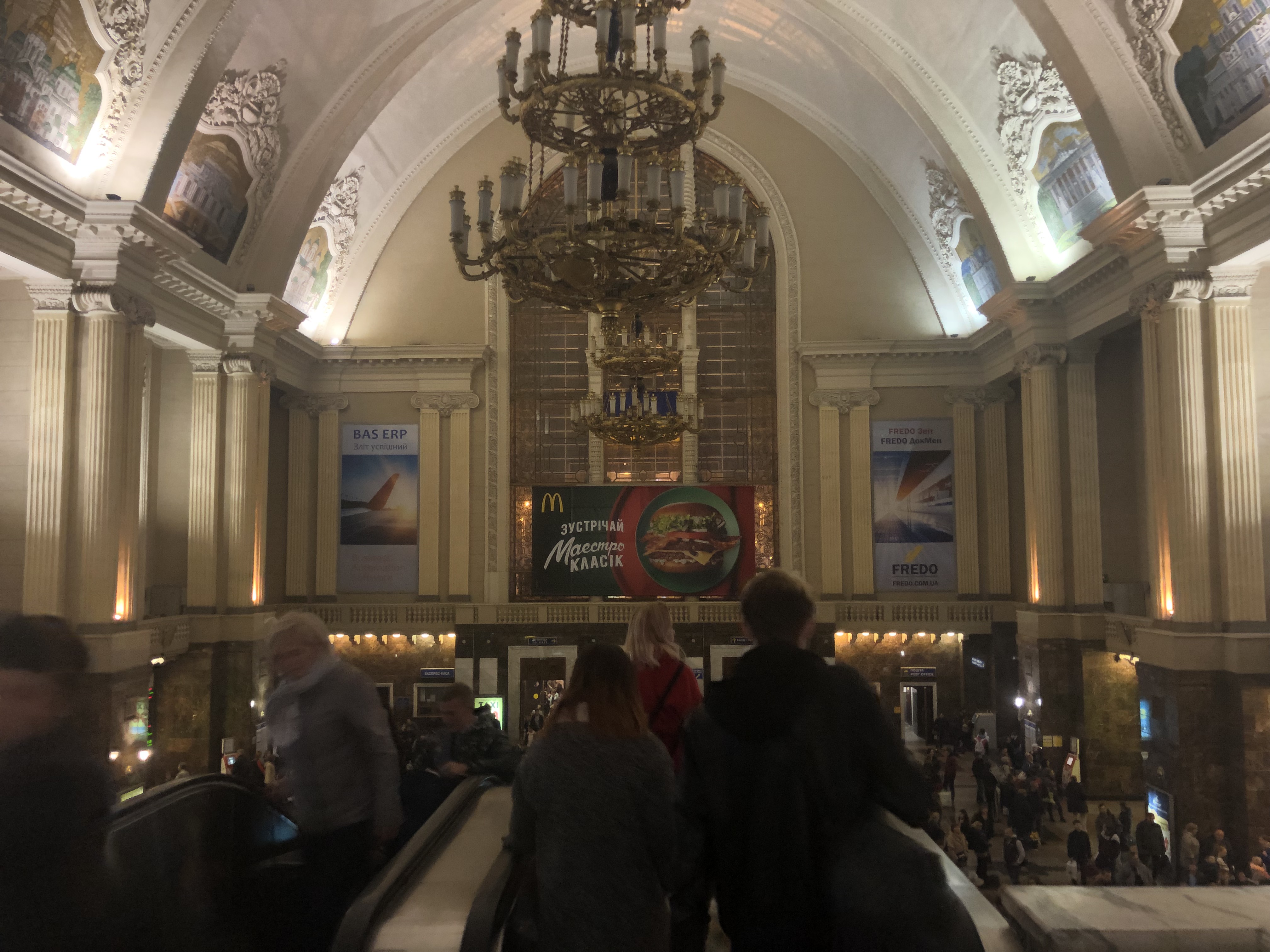
The railway station in Kiev is a rather grand affair
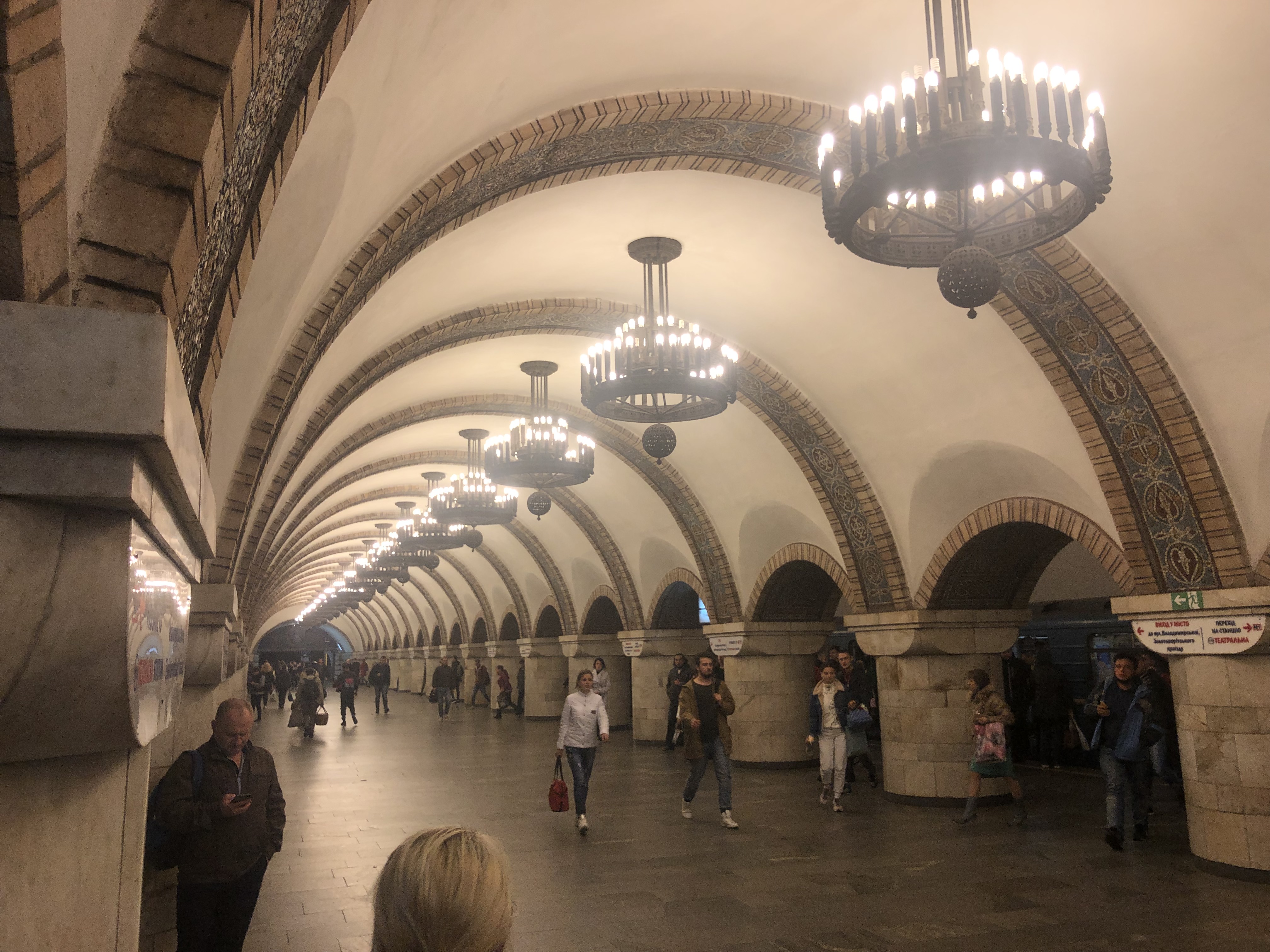
Even the underground stations were all marble and chandeliers!

A haughty Ukrainian lady behind the counter understood us well enough to help us find the right train to get on in the grandioise underground station – and we did a really good job of changing at the right times to get to where we needed to be. A bit of wandering and we found the building we needed, only to find no response from calling the number we’d been given. Bugger.

Whilst Rich continued to try to get in touch with the apartment owner I perused where we needed to be the following morning for our trip into the zone. Right outside the main railway station – where we’d just been, and quite early in the morning! Recalling there was a giant Ibis hotel right there, and that we were paying for the apartment on arrival, I suggested we go back to where we’d started and get a room there.

So we reversed our underground journey successfully – both legs cost us about 40p each – and quickly checked to see if booking online would beat the room rates advertised outside the Ibis hotel. No such luck, they were the same so we availed ourself of a room – happier in the knowledge we just hand to stumble outside to find our transport for the next day.

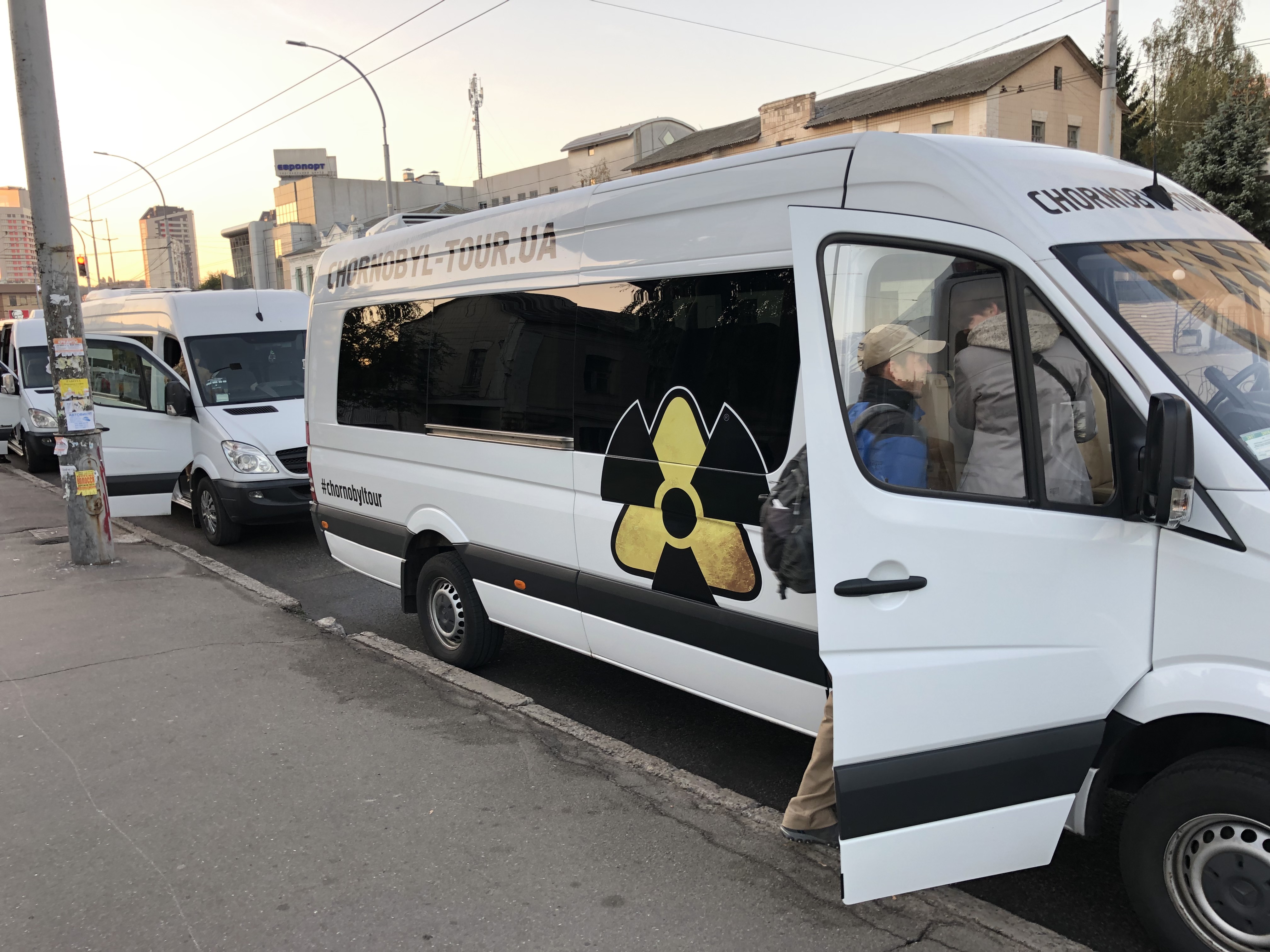
I think this is probably our minibus…

That morning we headed down to the street which was lined with minibuses bearing radiation signage – Chernobyl Tour were our trip organisers and soon enough we were checked in and sat on our minibus with a group of people from all over Europe. We had an excellent English-speaking guide (shamefully my delaying writing this means I’ve forgotten her name – I’m so sorry if you ever see this!) and we were underway!

The first obstacle was getting into the zone – it’s guarded by the military who had advance notice and check-lists of visitors, there was a stumbling block for me – my passport doesn’t have my middle name on it, but their list did – this seemed to cause a considerable amount of consternation from the officious Ukrainian soldier checking us in – I thought we were going to fail at the first hurdle but luckily our guide interceded and smoothed things over! That was just the first check-point!

Final check-point – you’d be in trouble if you got caught taking a photo of the actual check-point!

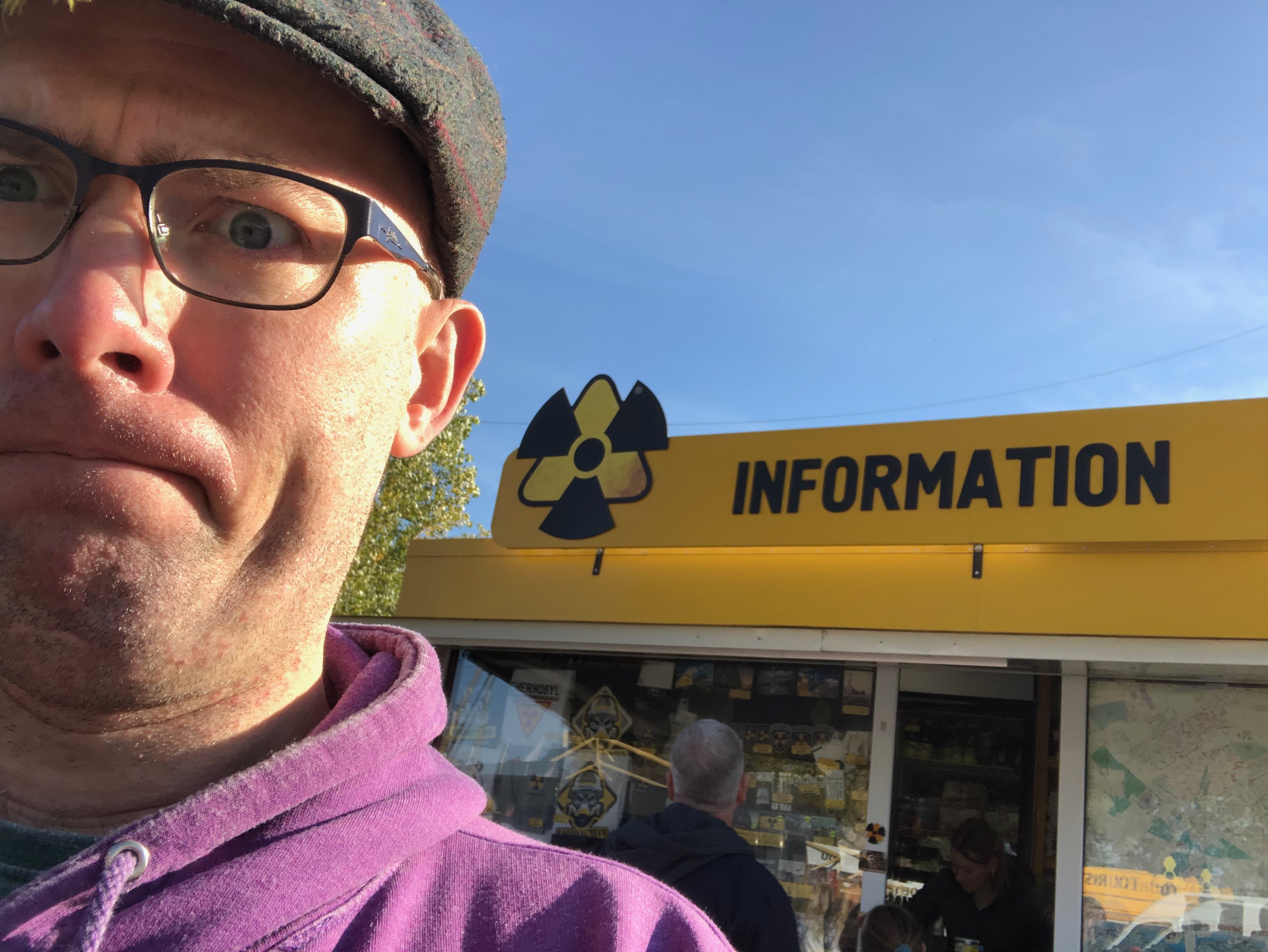
Before entering the exclusion-zone proper there’s another check-point complete with souvenir shops. Officially we were not tourists but ‘visitors’ to the zone – but clearly there’s recognition that there’s a commercial opportunity here. Mercifully we were able to traverse the check-point without issue this time and drive on. Once in the zone there are a number of sites we visited, our guide cunningly planning an order to try to limit our exposure to the number of other groups touring the area.

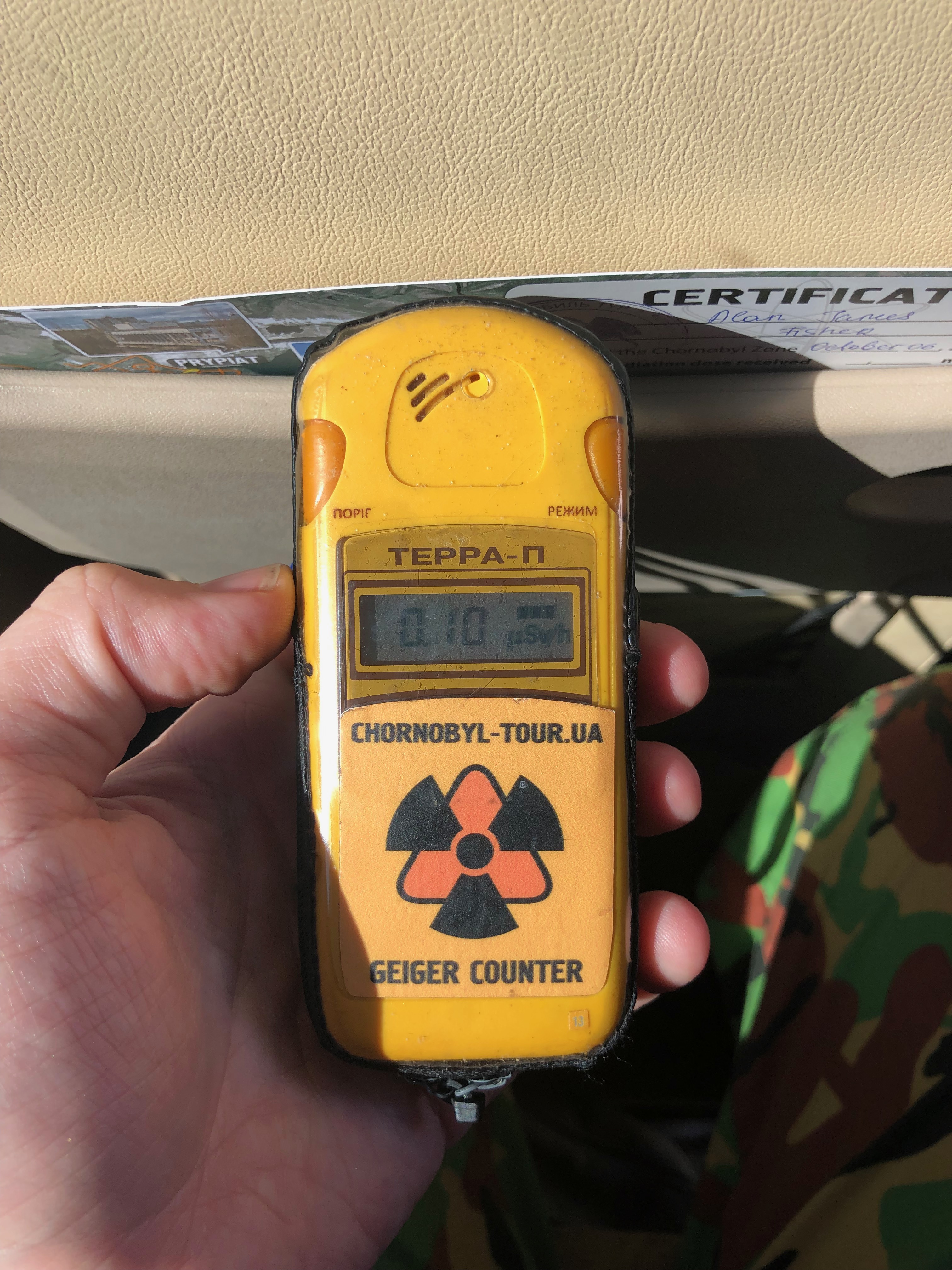
Trusty dosimeter..

Our first stop was the village of Zalissya – overgrown and long-abandoned we were able to wander around what were presumably paths at one time, now reclaimed by nature. A fair few buildings were still standing (many were bulldozed in the zone after the disaster before the realisation that disturbing contaminated earth was probably a bad idea). We’d been each equipped with dosimeters which enabled us to both identify radioactive ‘hotspots’ as well as cumulatively measure our exposure during our visit.

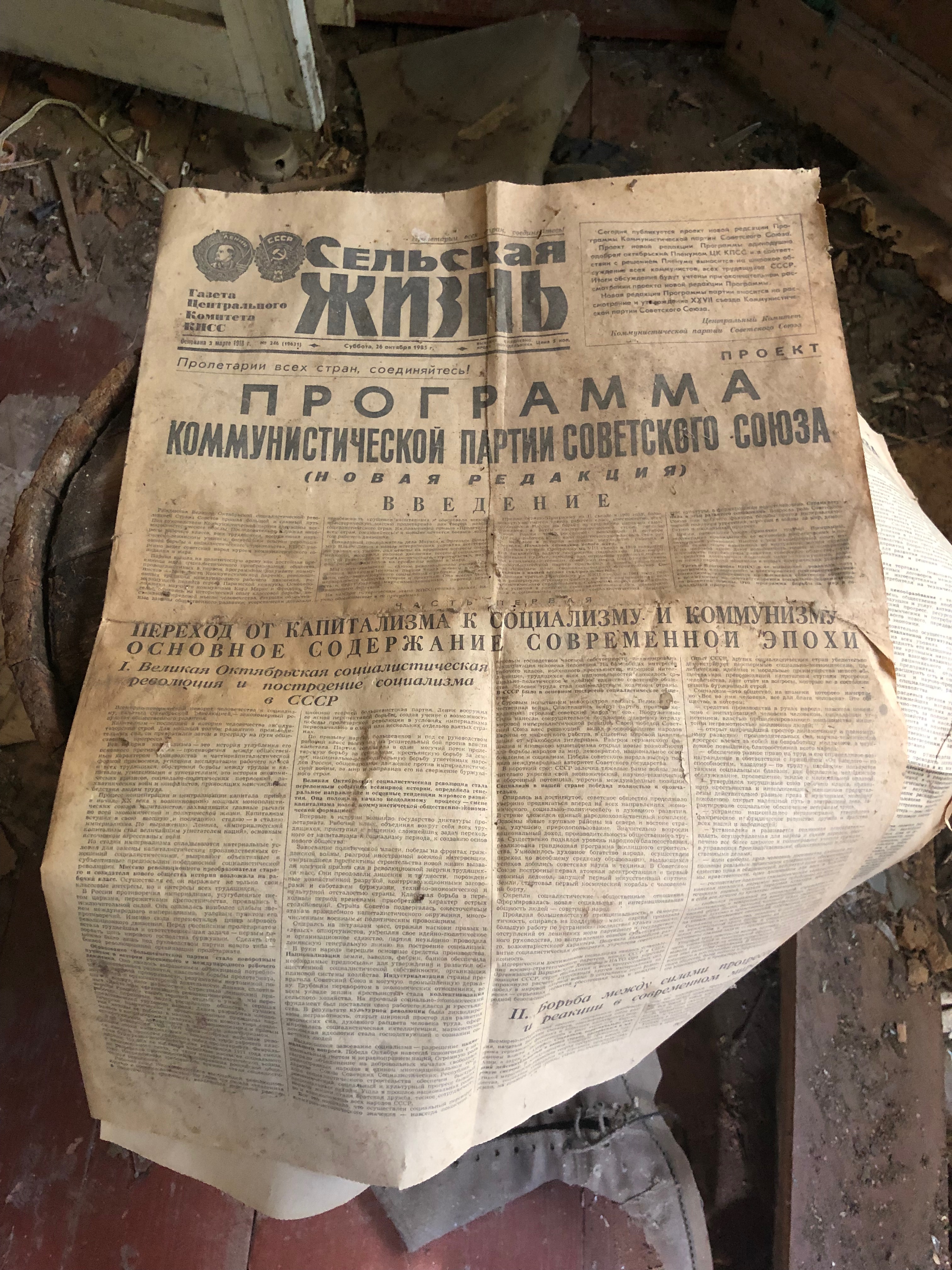
I read the news today, oh boy…

There’s something I find both harrowing and strangely comforting about abandoned places – comfort that nature moves back in, that human endeavours ultimately don’t count for much, but also sadness – music cards, newspapers, clothing – things that were once cherished left behind in the wake of an epic human folly. It was a great way to become acclimatised to this fascinating place.

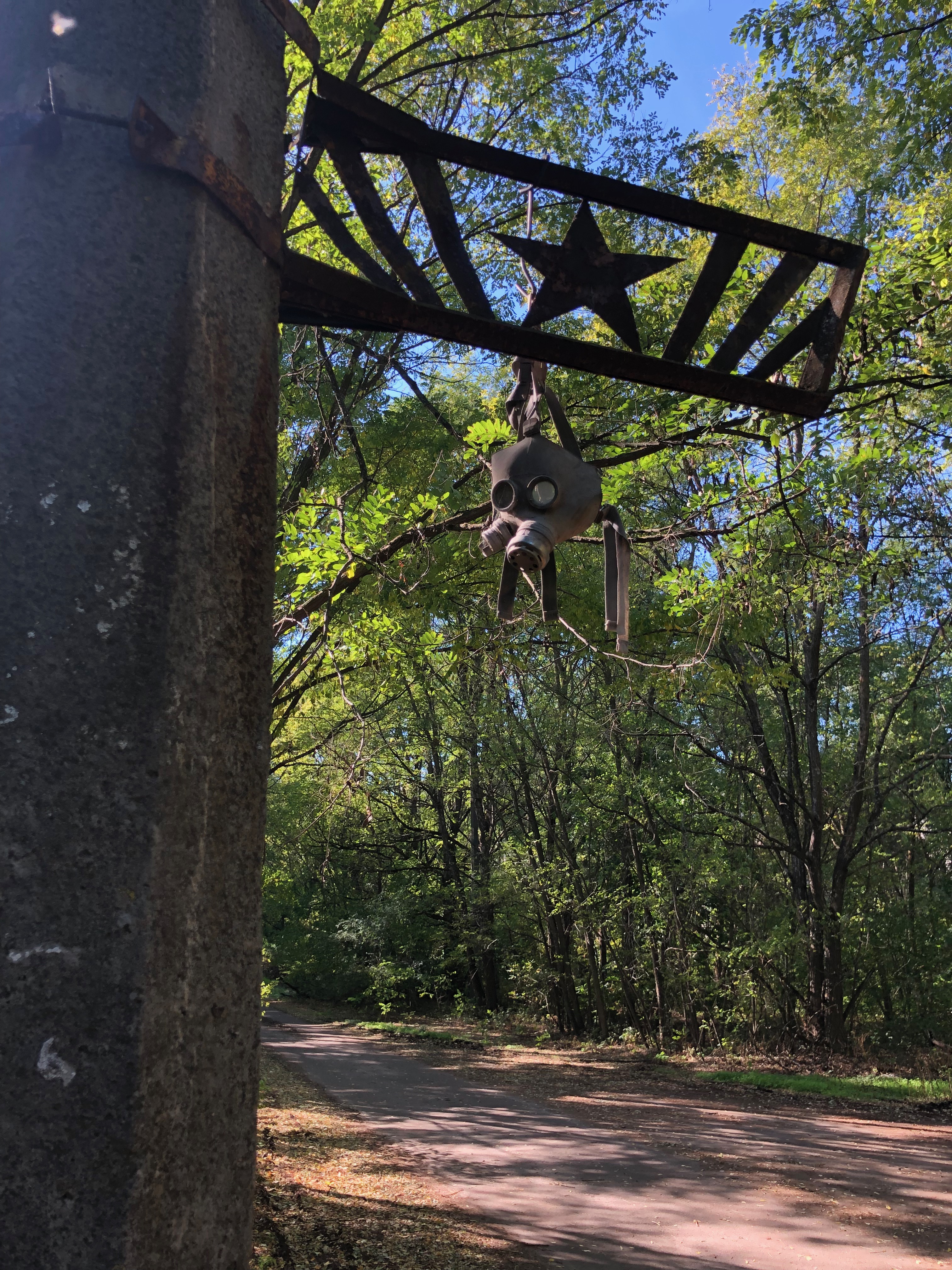
A short drive later took us to the kindergarten – sinister dolls and childrens toys and cots set an eerie scene. Whilst I’m sure explorers both official and otherwise (those that sneak in without permission are referred to as Stalkers by the guides in honour of a computer game that features the zone as one of its settings).

Hello, Dolly…
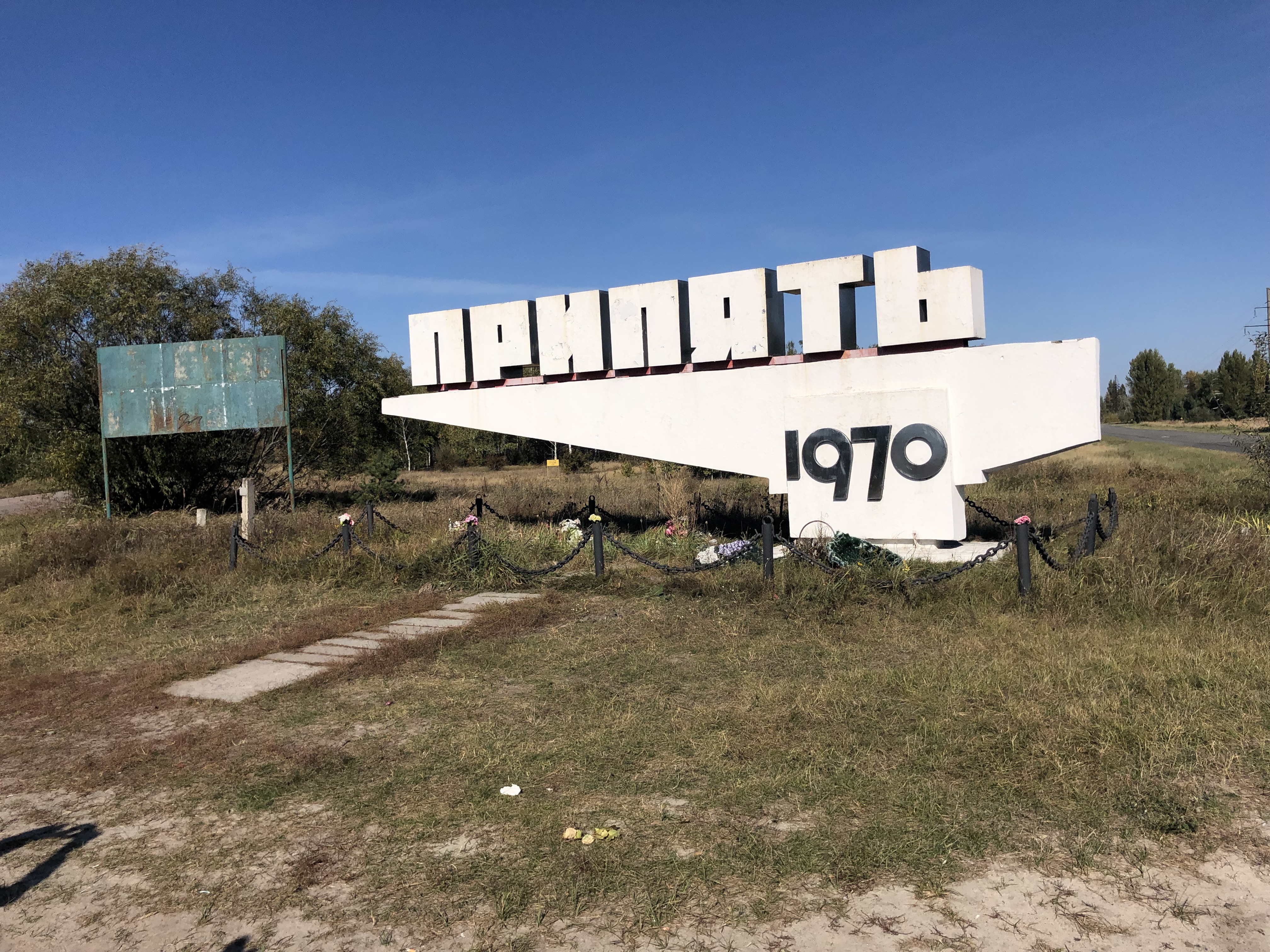
Entry to Prypiat…

It was Prypiat that was really exciting for me though – built as a showcase Soviet city to demonstrate their affluence, desirability in a cold-war era when propaganda was really important. Deliberately placed close to the power plant to demonstrate how safe it was, it was designed to be a flagship settlement with fantastic facilities to attract skilled workers needed to work at the power plant, and of course the ameneties they would want to mean their families moved in too.

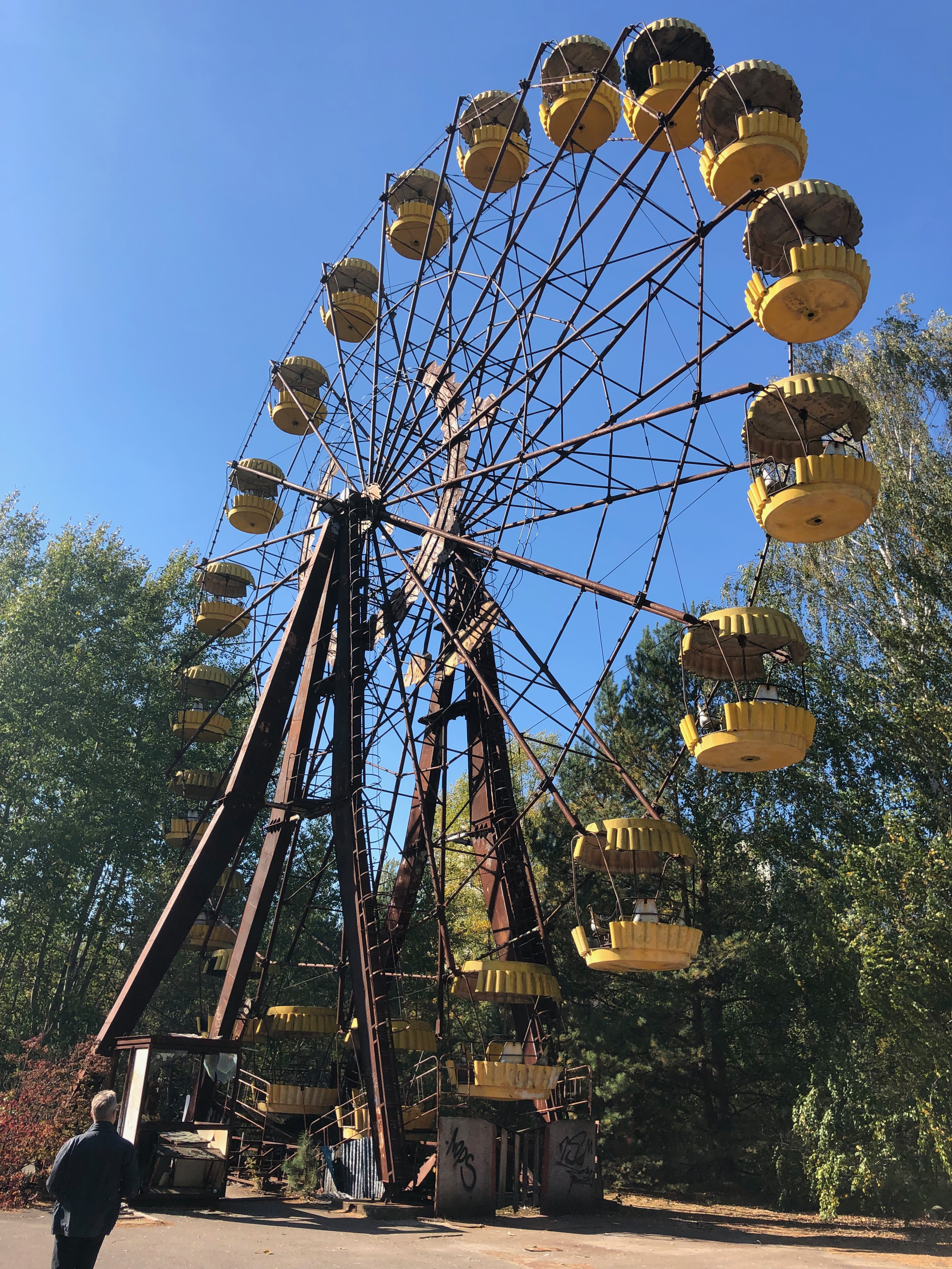
Fairground attraction

Trees close in on the roads and between all the buildings – tower blocks looming overhead it’s hard to picture what it must have looked like before. In the bus we’d been watching a DVD which included footage of the city before the disaster, and at various points whilst walking around the area our guide had pictures from the same points – it’s awe-inspiring to see how much its changed in not such a long time.

We saw the famous fairground, the swimming pool (which amazing was in use well beyond the disaster for people still working at the power plant, which was still generating power until December 2000 and countless other sites. Our guide was knowledgable and answered all our questions – it’s a difficult subject for Ukranians to tackle, ultimately it was a disaster done to them under Soviet rule – but they’re left with the consequences at the need to clear up the mess.

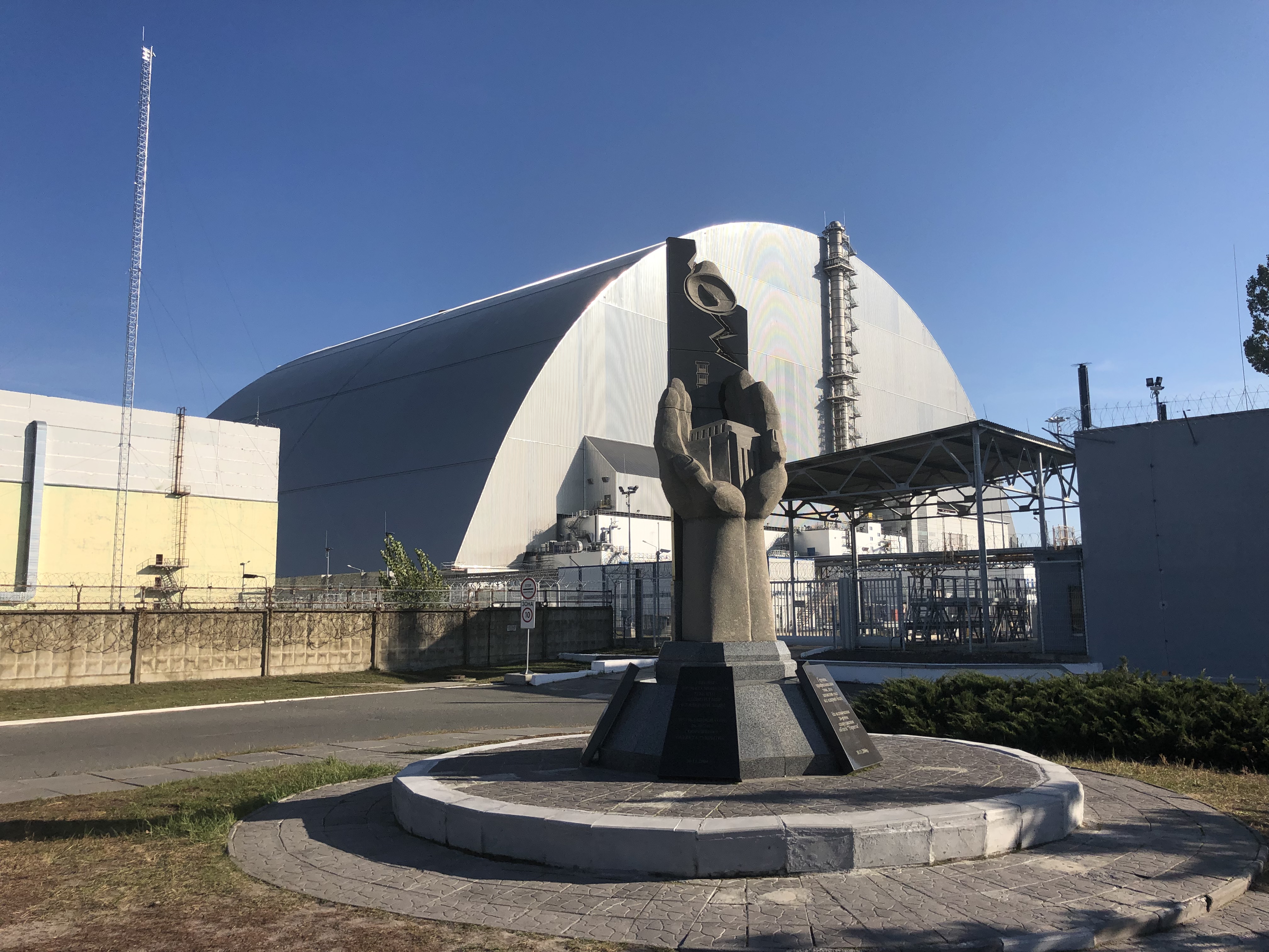
It was at once scary, awe-inspiring and a privilege to be able to stand so close to ‘ground zero’ – under that big steel arch is reactor 4

Having said that, the disaster was probably a big contributory factor to the fall of the Soviet Union too. The clean-up operation is still underway, as robots work under the new metal sarcophagus entombing reactor 4 (which was originally contained by a concrete covering). It’s a political and practical minefield which I can only really scratch the surface of with my limited understanding.

Much like I’ve really only scratched the surface of our visit with this post – it would be impossible to do it justice, if this sort of thing interests you though I’d heartily recommend a visit, it’s fairly inexpensive by our typical tourist fee standards and absolutely fascinating.

Unbelievably our trip included a hearty lunch in the cafeteria a mere stones throw from the reactor itself. We were warned not to take photos of the surly babushka’s serving us – the food was really good! I also got to make friends with some dogs outside, presumably descendants of abandoned pets who escaped the death squads who pursued them in the aftermath of the disaster. Life finds away – indeed, the Chernobyl exclusion zone is an incredibly successful accidental nature reserve.

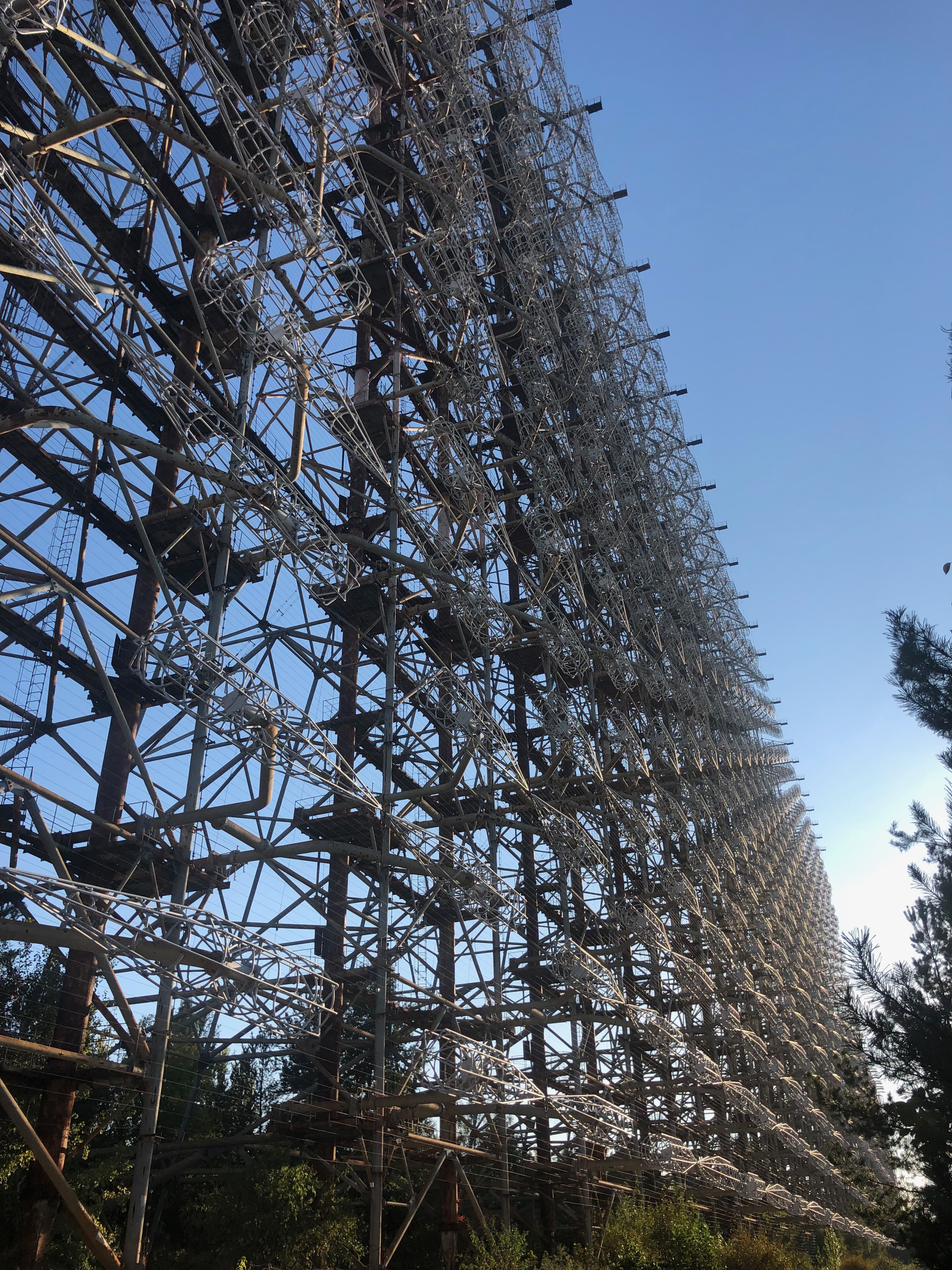
Duga 1 over-the-horizon radar system designed as an early warning system to detect incoming missiles

On the way out of the zone we visited the Duga 1 radar installment – once a top secret and fundamentally flawed missle detection system, now abandoned and unable to be demolished due to the contamination of the land, it’s a monument to the levels of paranoia that era had. Clearly it wasn’t deemed too secretive by the time of the 1970’s when it would’ve been visible from the tower blocks of Prypiat – although our guide suggested it would’ve probably been described to curious locals as a TV aerial or similar – certainly evidence of old check-points suggest that any intrepid inhabitants wouldn’t have been allowed too close to it.

Our last stop was in the actual town of Chernobyl, quite distant from the reactor that it named it’s actually inhabited. People can only live there for 3 months at a time before leaving – there’s a cafe, there’s even a hotel which caters for folk undertake multiple day excursions. The population there are involved in the clean up operation – and storage of other nuclear waste which takes place within the exclusion zone.

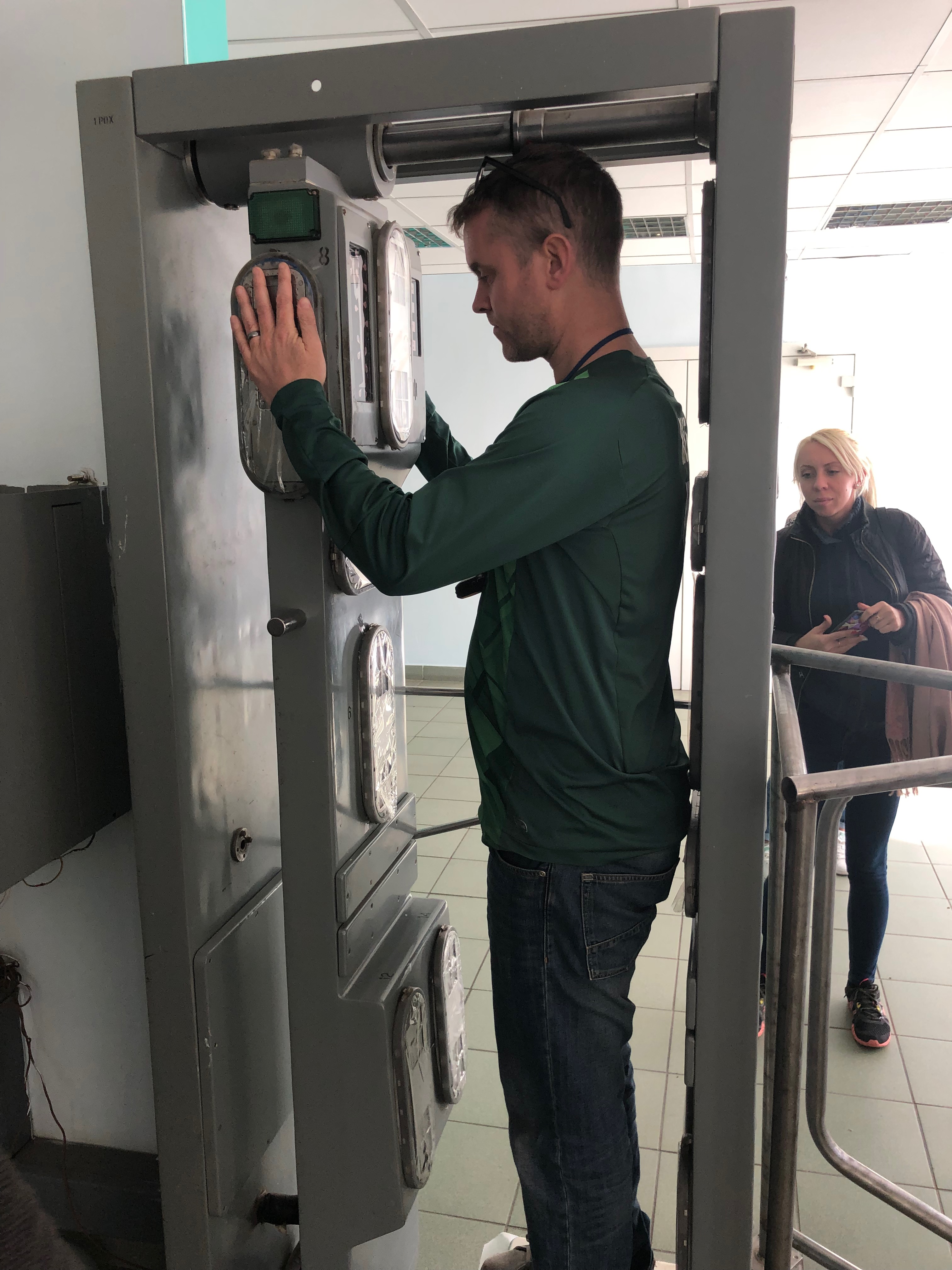
A quick radiation check on the way out, and we’re good to go!

I know that there are pockets of people who have returned to their homes in the villages of the zone – we didn’t encroach on any of them, whilst it would undoubtedly have been a really interesting experience – instead heading back out of the zone and back to Kiev via a final chance to stop for souvenirs and a radiation scan to ensure we’d not picked up any nasty particles. One of our party did set off something, but he didn’t look too perturbed after returning from whereever he was whisked away to.

Checking our dosimeters upon exiting the zone showed that we’d been exposed to less radiation than we had received on our flight from London to Kiev, so all in all, a pretty safe endeavour!

We spent the next day exploring Kiev which is a massive and beautiful city – we witnessed the Ukrainian ministry of silly walks, I resisted the urge to bungee jump off a bridge, but amazingly we found a bit of beach by the river and it was warm enough to sit and bask whilst munching on snacks we’d found at a nearby shop. If you fancy a city break with a difference then I could heartily recommend this!

In the meantime, if you have any ideas for an epic 40th birthday idea for Rich then I’m all ears!

Categories: Blog, Exploring | Leave a comment

Out and about again..

Lots more exploring of late – some re-explorations, some expansions, new discoveries and future plans.  I’m not quite sure what has prompted this odd behaviour but it’s getting me out and about and helpful for project Fatty, so I’m not complaining!

Having visited Mum and Dad’s new house and had a MASSIVE mixed grill I headed out for a long walk to work off some of it – I ended up off down the old railway track, this time I found a way through to the Netherfield Lagoons near the end of the railway line.  This does hark back to childhood, my Dad used to often take Rich and I down there (when it was just abandoned industrial land).  I got down as far as the River Trent.

Looking back to Gedling from Netherfield Lagoons

I must revisit and find some old haunts – I ended up on some rather sinister open railway crossings whilst idly looking for some old tunnels we used to use to shoot Dad’s air rifle.  I didn’t find them so eventually started to head back in the direction I’d come – the walk ended up being around seven miles and a fairly brisk pace, I was flagging a few times as my body came to terms with activity and the monumental amount of dead animal it was breaking down.

A new discovery for us was a joint mission with Cat – we headed out for a jaunt to Gedling Woods, this too was working off the excesses of Dad’s 60th birthday party where much buffet and drink was consumed.  It started with a wander through the streets and alleyways and eventually we found ourselves at the top of a steep hill and at the woods – we lapped the woods, then lapped the meadows near Carlton Le Willows school before heading back – finding some mystery footpath which eventually dropped us onto the railway track.  We ended up with a four mile walk.

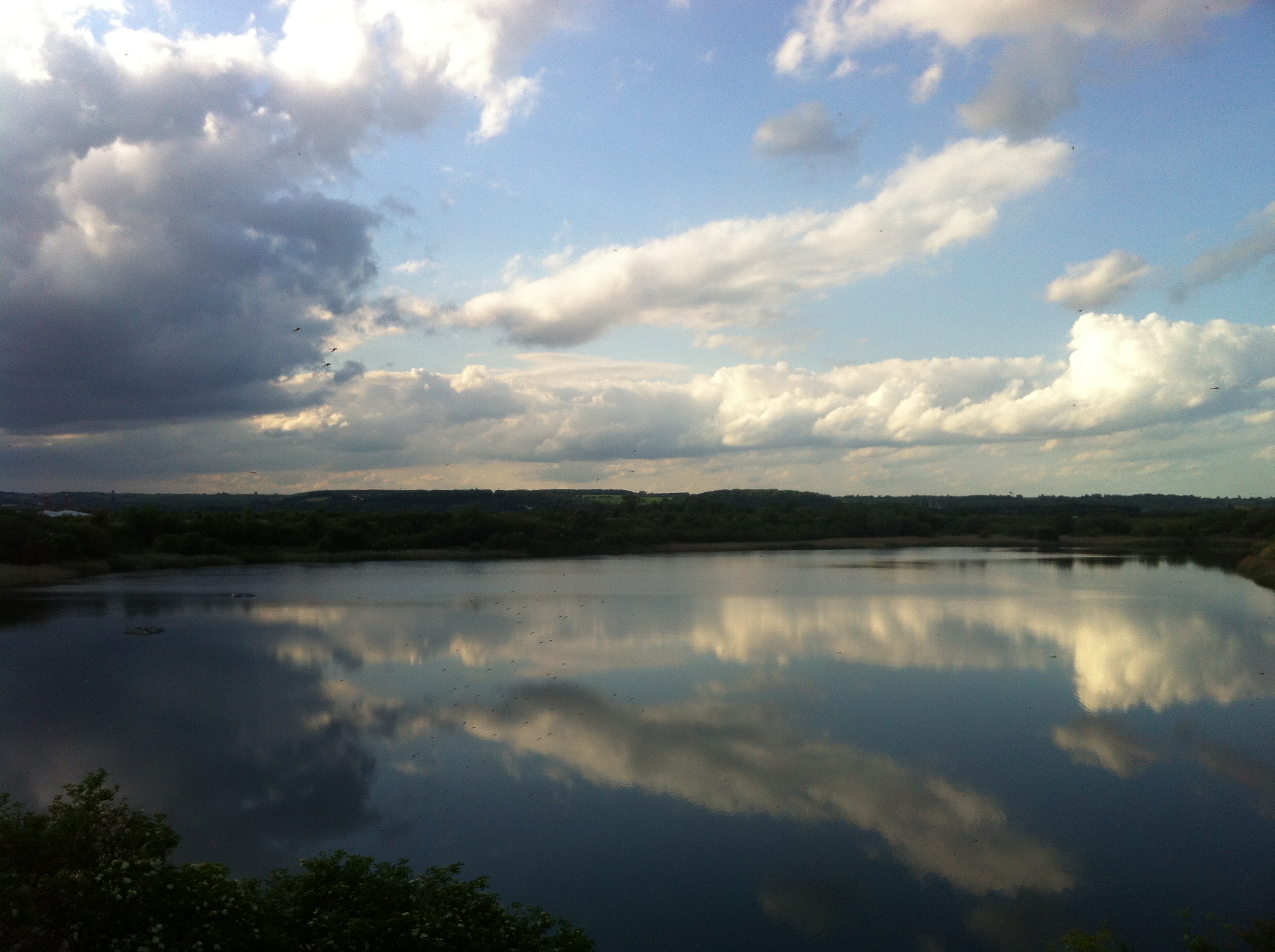
Looking towards the River Trent from the top of the meadow at Gedling Woods

Then another rediscovery – my previous tunnel antics had awakened the interest of some friends so I’d agreed to act as a guide for another visit.  So Rich, Phil, Chris and I went for a wander in the old tunnel again – it was a good laugh.  I have other folks interested too, perhaps I should set up a business.  I was reading about the future development plans for the site – there should’ve been 700 houses there last year, I guess the recession is biting, it’s doing me a favour though!

Hopefully the development continues to stall, whilst the industrial part of the site isn’t that pretty, and most of the nature reserve will be preserved, it would be a shame to have a new big estate right on our doorstep and the inevitable closing off of the tunnel which will be really close to where the housing is planned to be.  We had a few amusing ideas regarding the tunnel, perhaps more on that later.  I await my next party to tunneldom with excitement!

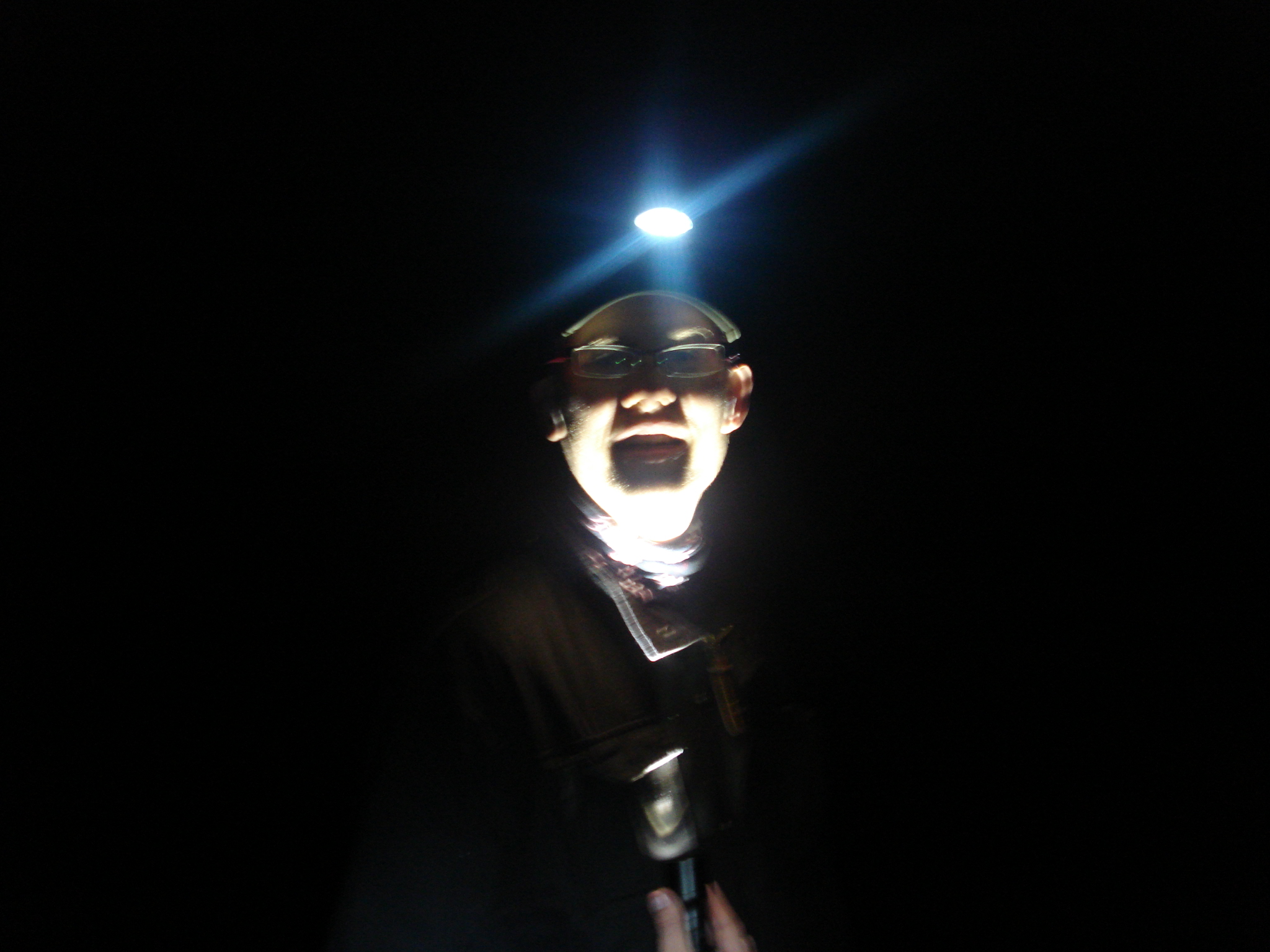
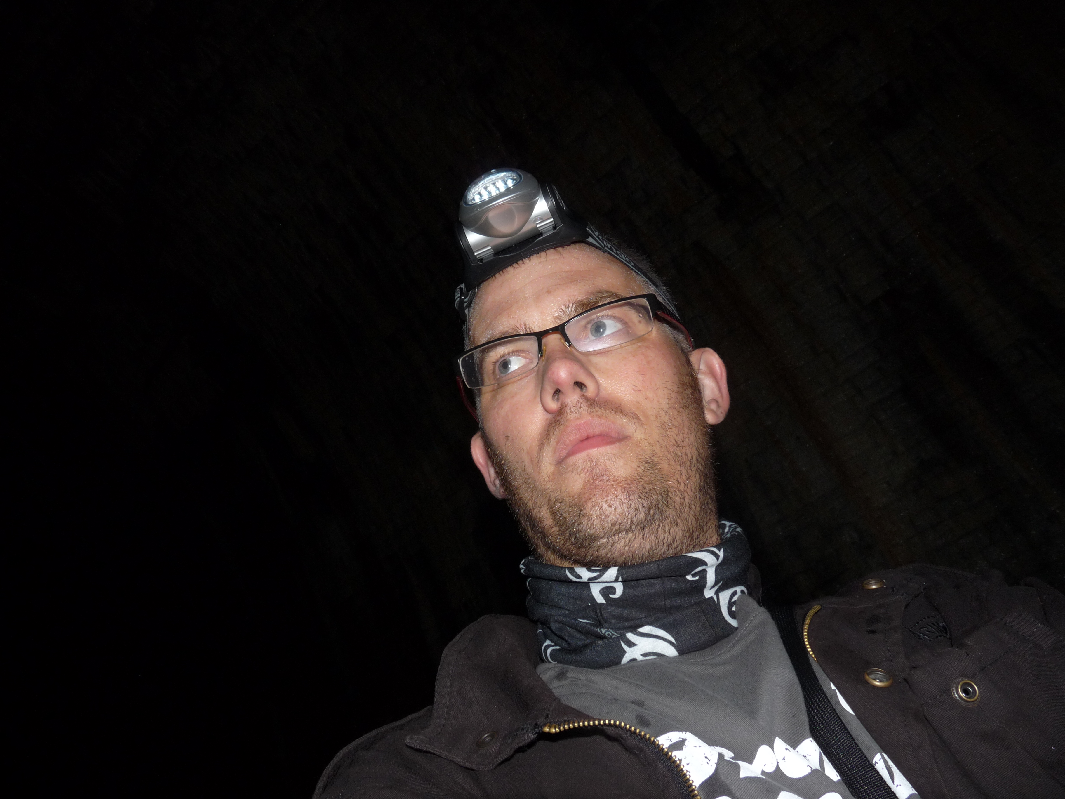
The ol’ ‘torch under the face’ routine makes me look a bit like my mate DanR!

Then a future plan – thanks to Mike observing our exploring antics on Facebook he’s alerted us to an abandoned half-demolished asylum that is ripe for some wandering about for strange middle-aged men – so in that spirit we’ve made plans to do so on Sunday afternoon/evening when there’s apparently no security there.  I shall take the camera, of course.  There’s a couple of embryonic thoughts of sites in Nottingham to look at too.

Categories: Blog, Exploring | Leave a comment

Underground, overground, wombling free..

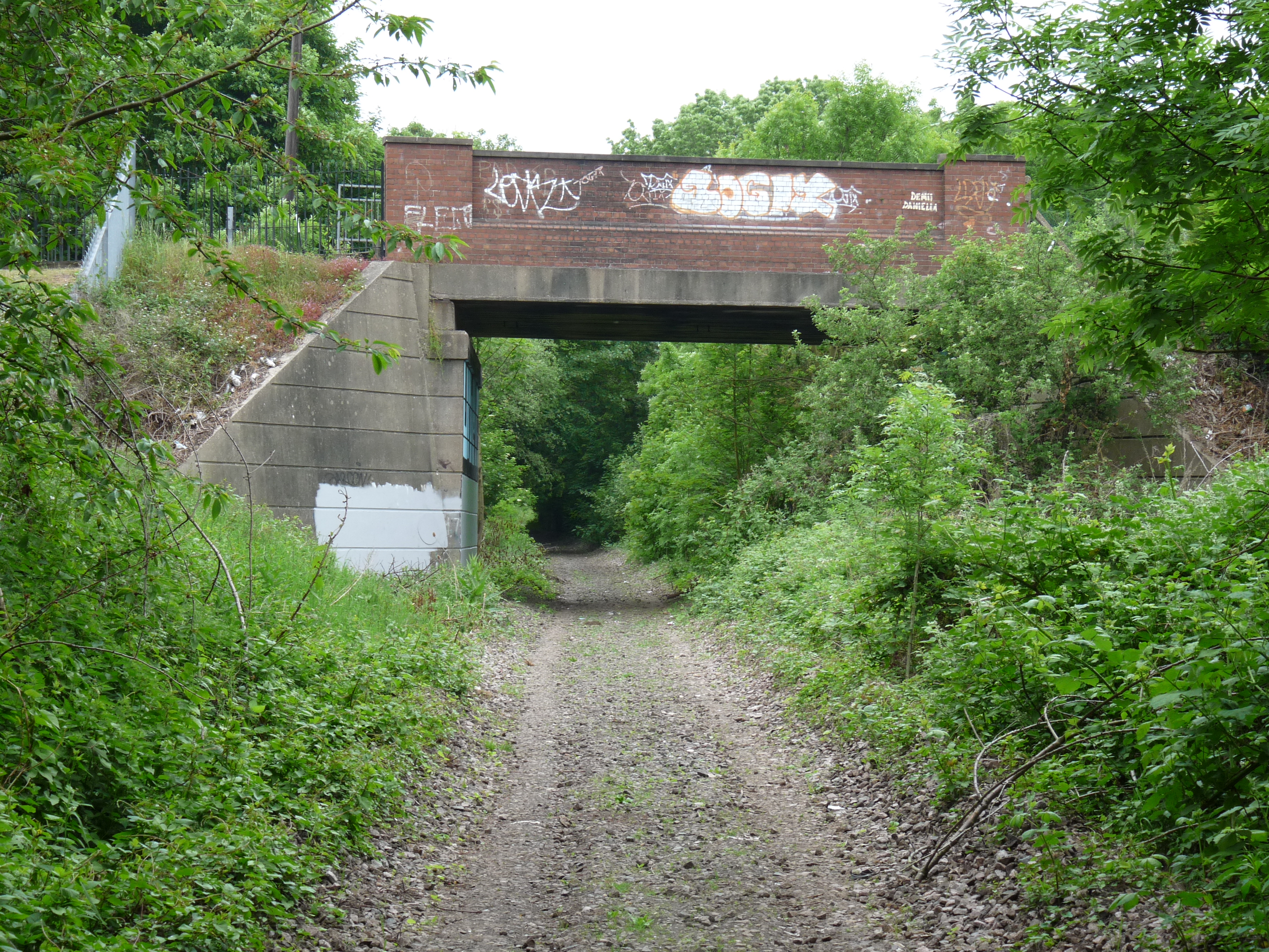
Lambley Lane crossing over the disused railway line

So, having been exploring the Gedling Pit site and as an offshoot ending up going underground, I was pondering the feasibility of hooking up with the old Great Northern railway line that ran through the tunnel in the other direction, getting a different view of areas I’m very familiar with.  Effectively the line actually very nearly connects Cat and I’s current home in Gedling with my old house in Netherfield.

Burton Road from above

It’s really easy to get onto the Railway line at the back of the park on Lambley Lane – and it’s pretty much open, and quite widely used, I encountered a few dog walkers, some kids who ran away from me before reappearing to ask me where the track led, a couple of blokes using it as a shortcut from the shops.  Walking from the pit site you get to go over a few of the small bridges that I’ve driven under countless times, past the former Gedling Railway Station and then over the bigger bridge near the bottom of Shearing Hill crossing Burton Road.

Alongside the Recreation Ground there’s an attempt to block the way off with fences where the old route crosses the active railway lines, but the fences have been ‘adjusted’ and you can get through, you go past the allotments, and the route arcs towards Victoria Retail Park and under the Colwick Loop Road before terminating at Victoria Road on Netherfield with a substantial fence and no gaps that I could  find.  Shortly after this crossing the line rejoins the main and still-active line near Netherfield Station anyway, so it’s not too frustrating to have come to an end at this point.

Surprise little wood…

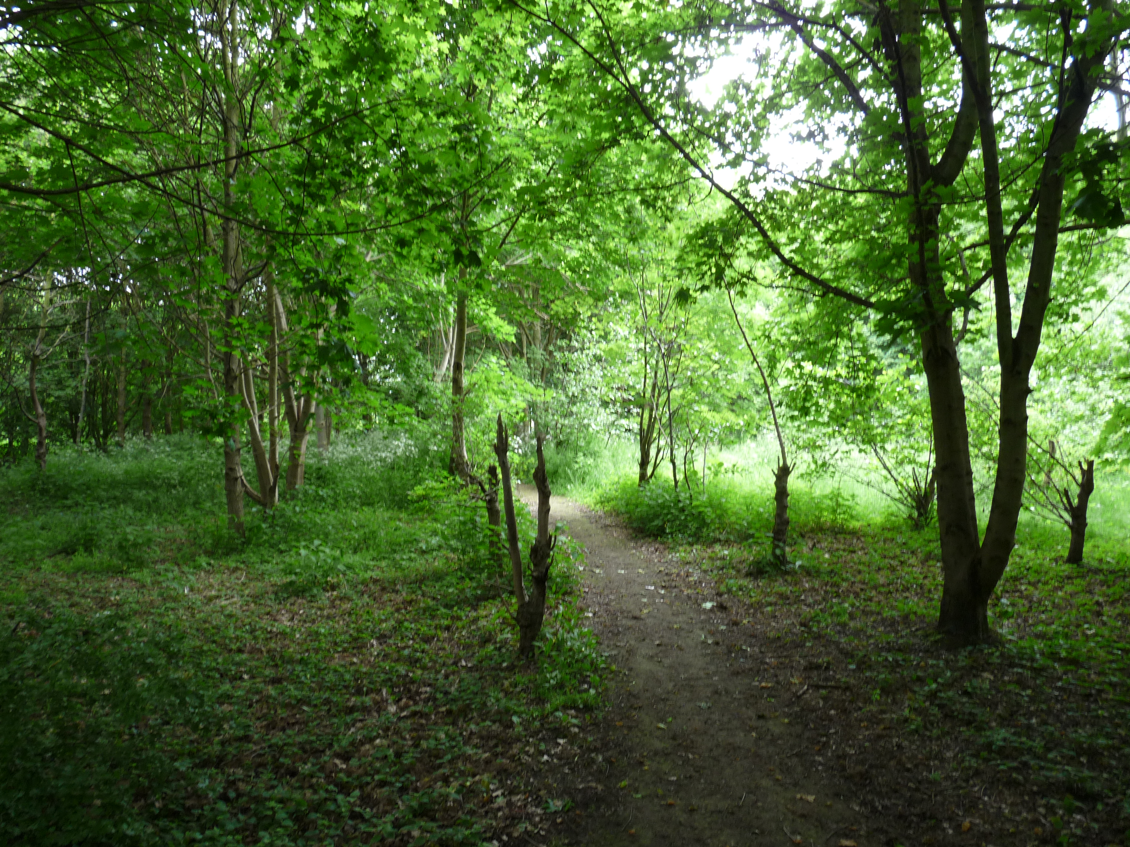
So I turned back and decided to head through a well-worn path off to the side which took me to a path that leads through to Netherfield, to the right there was an idyllic woodland that occupies the space between the Railway Line, the Loop Road and the Allotments – very pretty, with paths all over it none of which seem to lead anywhere in particular.  So, I headed back to the path to Netherfield, took that and meandered in and around the Loop Road before ending up back at Burton Road Recreation Ground.

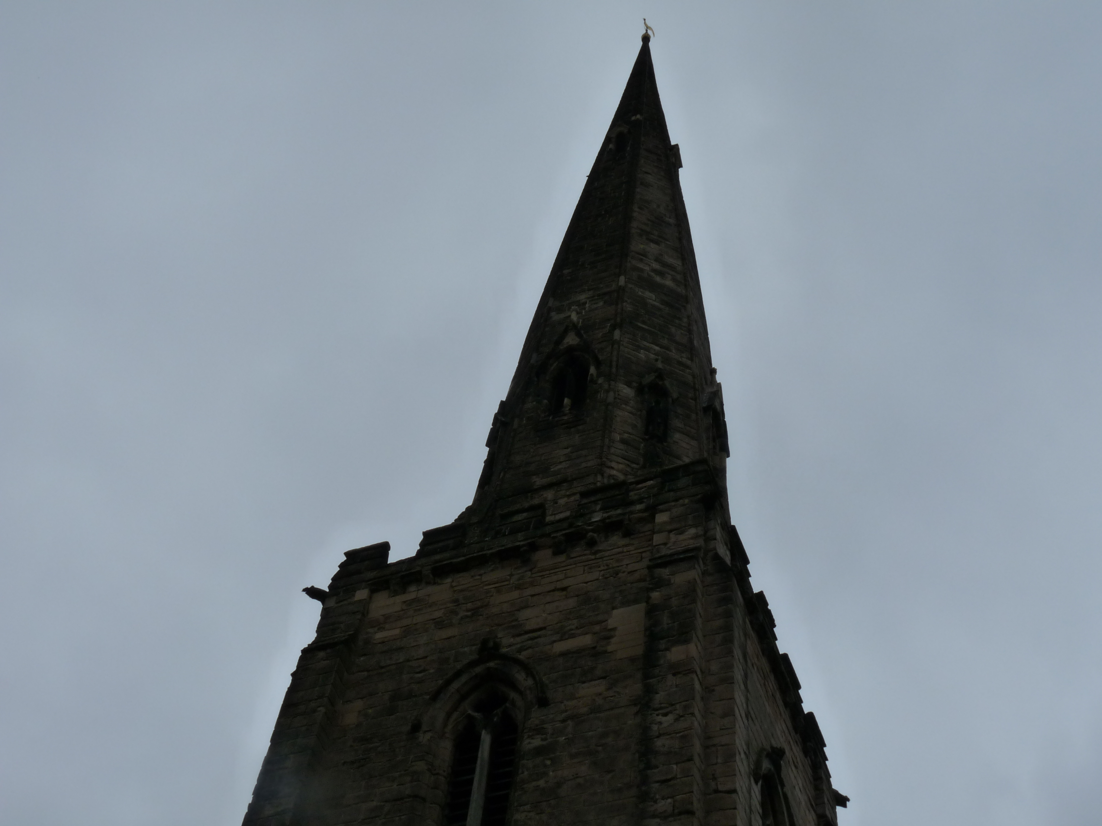
The spire of All Hallow’s Church in Gedling

Then it was a case of walking back home on the road route, which meant I could see glimpses of where I’d been from a more familiar position of the roadside, it also meant I could walk back through Gedling itself which through familiarity is sometimes easy to take for granted – it’s a place with many lovely things about it, even All Hallows Church – a temple of oppression – is ridiculously idyllic.  The until-now unnoticed information board near there taught me a few things, including a revelation of J.R.R. Tolkien being a visitor to the place.

So there you go, an overground ramble close to home that shows you familiar sights from unfamiliar angles – in a way I’m really kicking myself that I’ve never troubled to find these things before.  All the pictures I took are here on Facebook should you want to have a peruse.

Categories: Blog, Exploring | Leave a comment

Letters from the Underground..

So I’ve been out exploring again, and this time with some kindred spirits!  Thanks to my tendency to advertise my thoughts and planned activities on Facebook I was able to lure Doug and Dave into joining me on my re-visit to the Mapperley Tunnel – this time with a torch powerful enough to see where we were going.

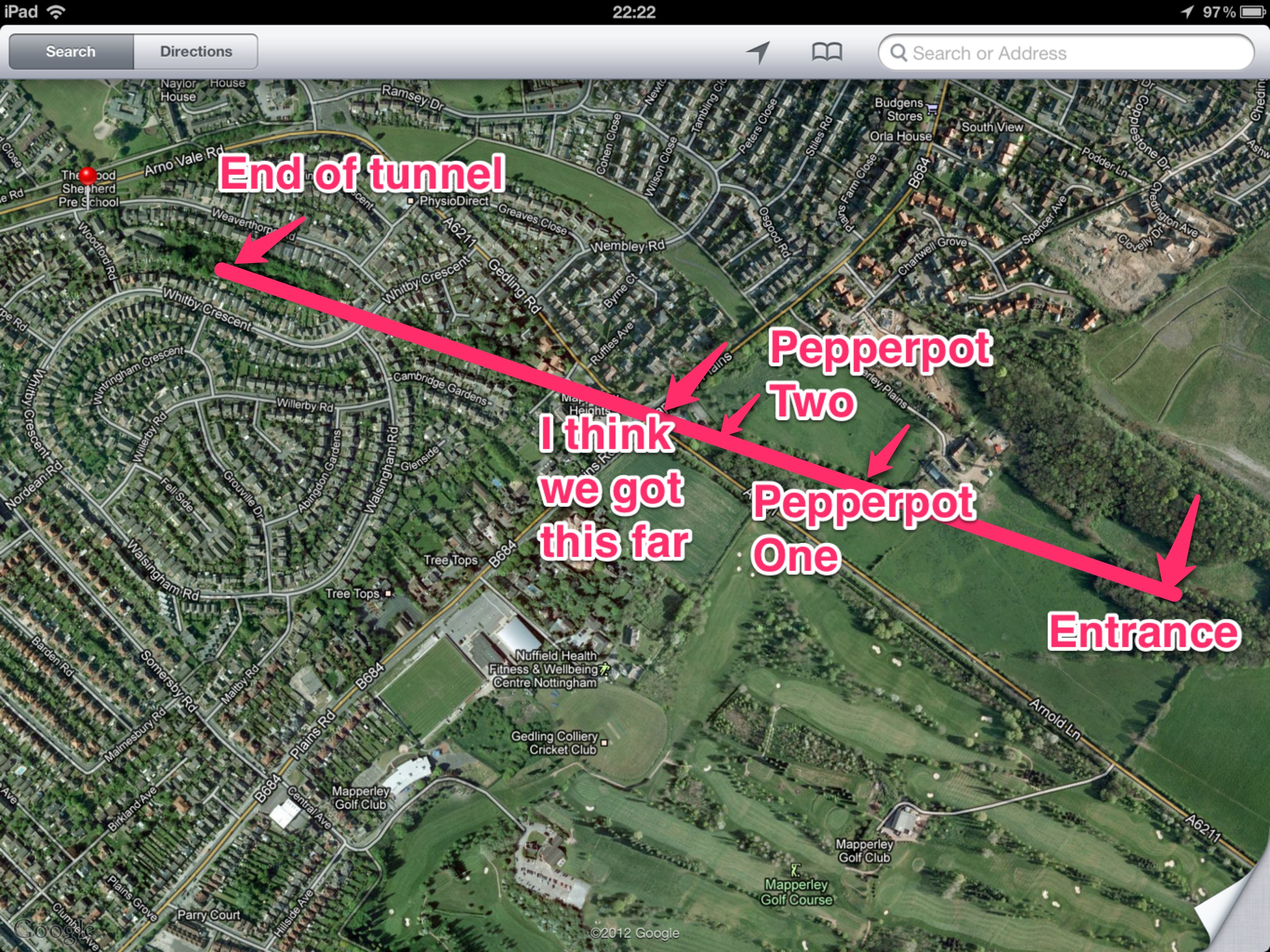
Having retrospectively done some working out on a map, I reckon we made it half way through the tunnel before turning back – after the second ‘Pepper Pot’ (air vents that above the ground resemble brick-built table accoutrements) the tunnel is partially backfilled with earth and rubble.  We did labour on for a while but with the ceiling increasingly getting lower and uncertainty about how much further we could get we eventually gave up I think somewhere under Woodborough Road/Plains Road itself.

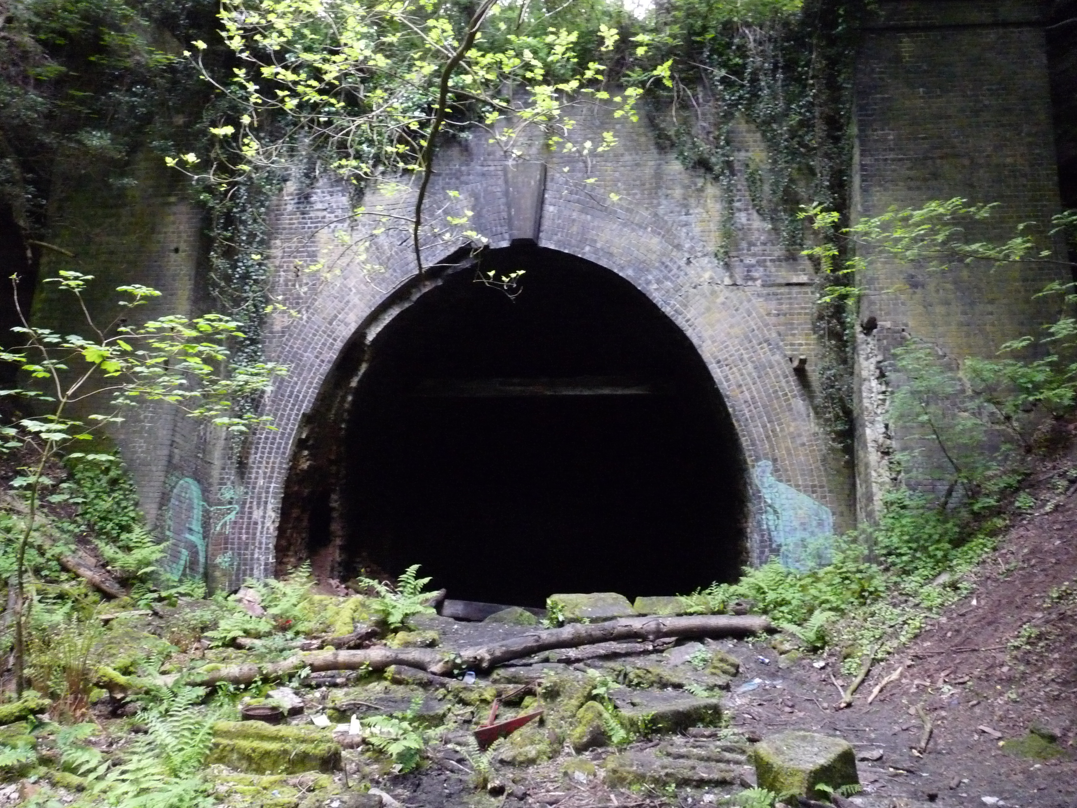
So, the start was the slightly awkward process of meeting each other at the old entrance to Gedling Colliery – once our band was complete it’s a fairly short yomp through past the waste disposal site and into the woods to eventually get to the spooky site of the tunnel entrance, a valley strewn with fallen trees, a long-discarded car, some disposable barbecues that were new since my last visit (and we think we know the culprits for).

Anyway, new torch out – it’s small, but it’s mighty – and lit the way admirably, ably assisted by a couple of head torches and Doug’s LED monster.  It was quite boggy underfoot at times, and any adventurers need to watch out for holes in the floor at intervals.  To either side frequent alcoves, and often really quite pretty sediment formations due to the water that clearly pervades through nearly all the crumbling Victorian brickwork.

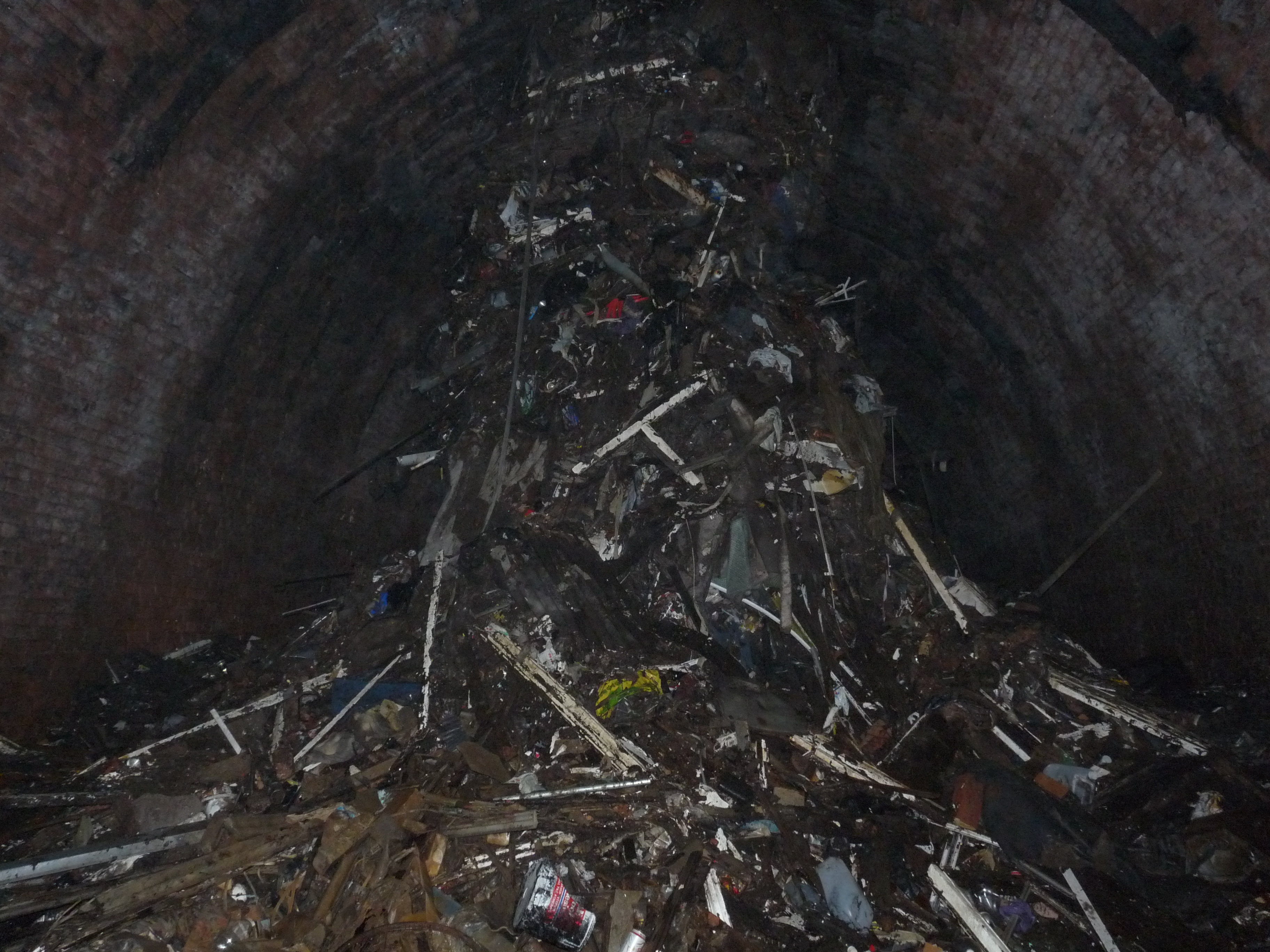
Yard markers are painted on the walls to help you keep track of distance (of course, we didn’t notice this ’til the way back), and so effective was the torch on wide-beam mode that we passed straight under the first of the two air-vents you can access easily without noticing the pool of light on the floor.  Fortunately we spotted it on the way back!  The second air-vent you can’t miss, because a veritable mountain of detritus has been thrown down it over the years, resulting in a floor-to-ceiling stack of crap.

We clambered around this and almost immediately there’s a ramp of rubble and earth where the backfilling of the tunnel began.  As the ceiling of the tunnel got closer and closer, and the beams threatened to knock out even Dave, we eventually (and slightly reluctantly) called it a day and started to head back.  Post-exploration mapping and estimation makes me think we made it around half way through the total tunnel length, putting us underneath somewhere close to the junction of Mapperley Plains and Gedling Road/Arnold Lane.

It’s partly sated my strange fascination with the place – although having seen the progress we made, and learned from a friend who went to Scouts at the Weaverthorpe Road Scout Hut that as kids they excavated their way into what seemed an open-looking tunnel at the other end only to be scared by some disturbed foxes.  So I can’t help but idly wonder whether or not the backfilling of the tunnel was never total, and with a degree of scrabbling and a lot of crouching it could be passable.  It wouldn’t be comfortable, though!

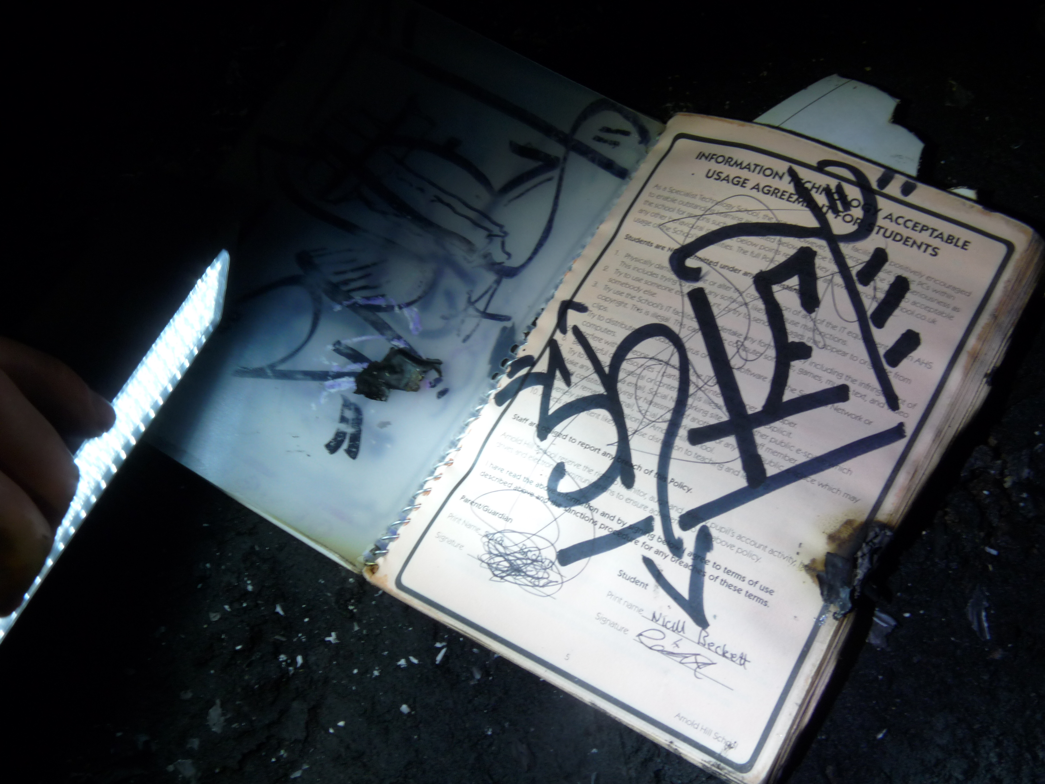
So, we headed back – more leisurely and more sightseeing.  Amusingly we encountered further evidence of the erstwhile barbecuers outside, a school planning from Arnold Hill, my old stomping ground, belonging to a child called Niall Beckett (who apparently has a bit of a thing for a girl called Chelsie, and a catalogue of excuses for not doing Physical Education).  Further down the tunnel back towards the entrance we found a Science workbook belonging to someone called Sam Harvey.

The reason we could make the link was other papers outside again featuring a lot of writing about Chelsie!  Funny to think that the last time I went any distance under the tunnel I was attending Arnold Hill School.

Another pleasant stroll through the woods and we parted company at the entrance to the Colliery Site feeling suitably pleased with ourselves – with plans to find other sites that might bear a good old explore (the big old warehouse near the BBC building in Nottingham is very high up in my list – and now I have found some kindred spirits it might just motivate me to make good on these impulses I have!).  For reference here’s my map of where the tunnel is and how far we managed to get before getting a bit fed up of bending over too much!

Photos of this expedition are here, and a (pretty shonky) video is here.

Categories: Blog, Exploring | 28 Comments

Meandering..

Given the weather is so warm I opted to pop out for a walk after work today instead of a run, craving some degree of exercise having missed out on Tuesday football and indulged in a lot of celebratory food and drink at my works’ ‘Best of the Best Awards’ dinner last night (I was pipped to the post in my category – Boots is a veritable haven of awesomeness when it comes to folk who do great stuff for charities and community schemes, so it was always going to be competitive).

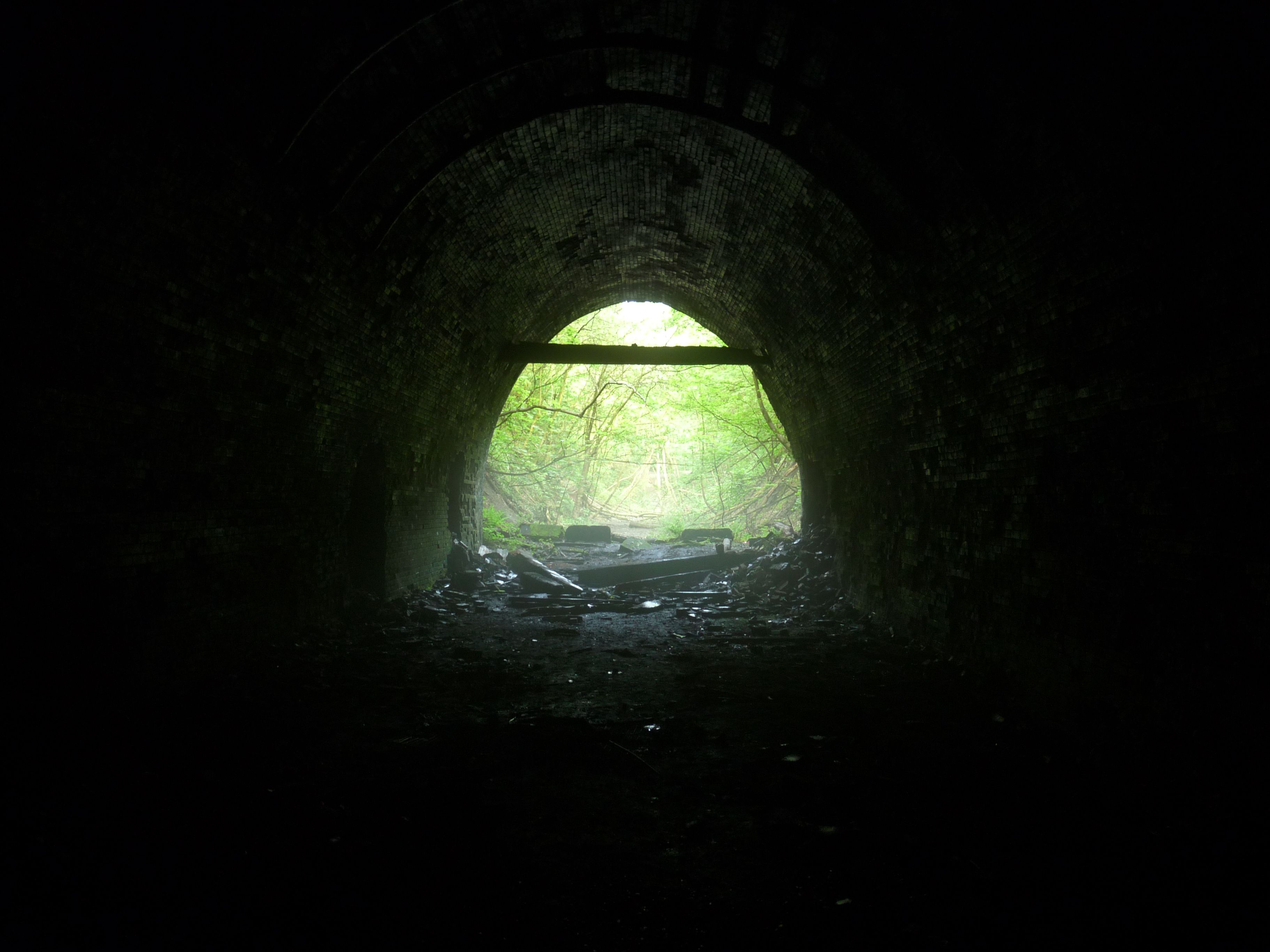
Looking out from Mapperley Tunnel

Anyway.. I decided to take the camera with me this time, and head into the old Gedling Pit site again.  I even chucked a head-torch in my pocket incase the whim took me to revisit the Mapperley railway tunnel.  I did revisit it, the torch was nigh on useless – a high power torch will be the way to go should anybody want to venture further down there.  So I continued an aimless meander and eventually found my way to the top of the old pit slag heap – this has grassed over and been planted with trees and is a nature reserve.

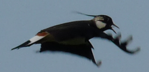
A defensive Lapwing circles me warning me away from its’ nesting site

There were echoes of the Terns on their island up north when some shrill cries accompanied a bird who started doing quite close laps of me warning me away from their ground nesting sites.  I retraced my steps a little and found a way without going too close by, it turns out they were Northern Lapwings – they have a degree of protection under EU law as their population has dwindled somewhat – so it’s great they’ve found a good habitat so close by to home.

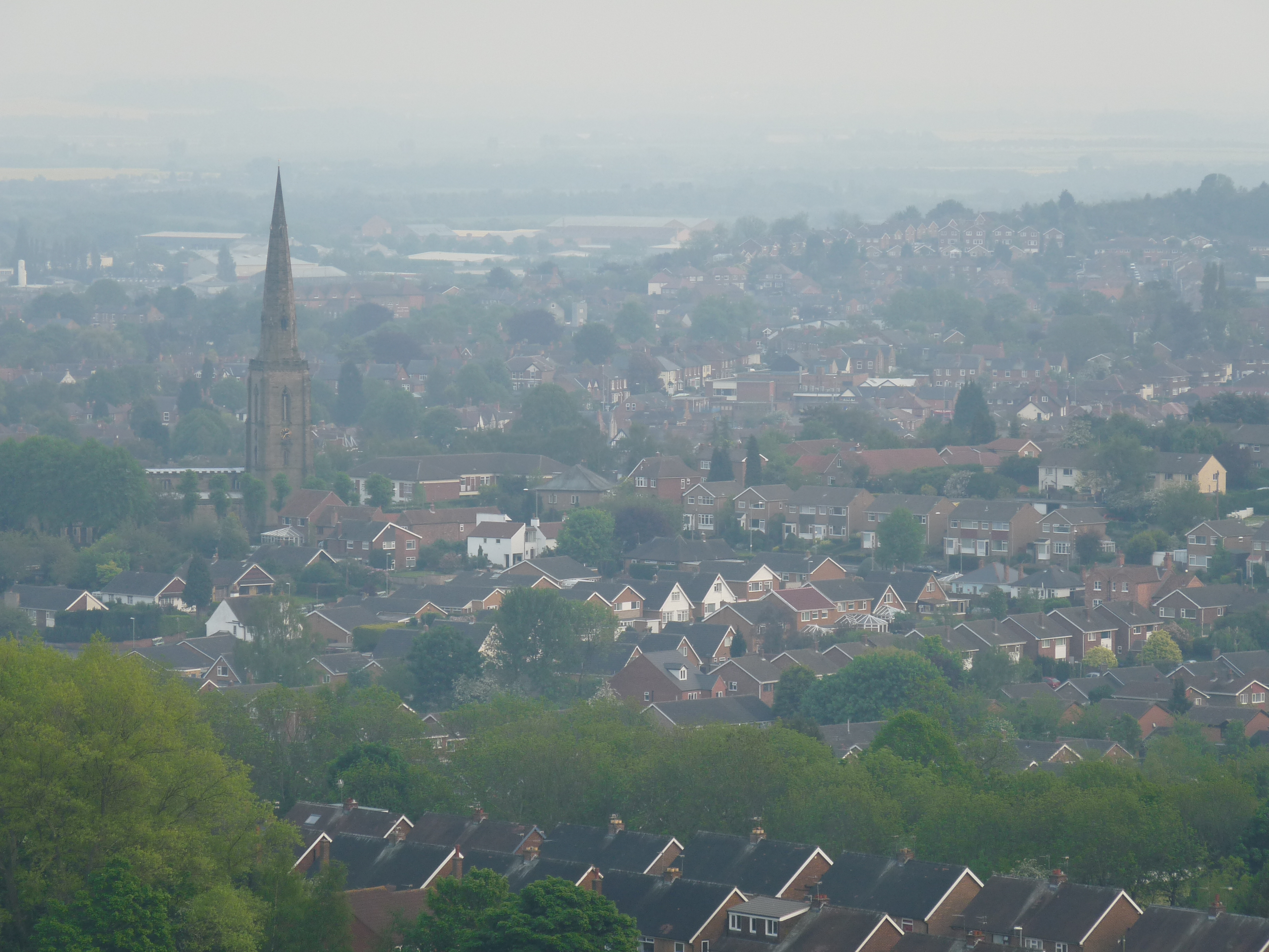
From the top of the slag-heap as was (okay, it is more charmingly known as Wicketwood Hill now if my phone’s map application is to be believed) you are afforded a lovely panoramic view of Gedling and beyond over the floodplains to the Trent.  There’s an easy way down to the top end of Lambley Lane too making it less faff to get back home compared to the meandering route I’d taken to get up there – it looks like you could get down to Spring Lane too – I must admit, I’m quite enjoying the childlike exploration of the local wilderness, I’m going to do some more of it.

Where we live we’re blessed with lots of lovely parks and countryside to explore around – as well as the echoes of old industry or transport that I find fascinating, whether it be abandoned railway routes (the railway line that ran through the Mapperley Tunnel through to Woodthorpe loops right through our estate and through Gedling down Shearing Hill (I think there used to be a station there years ago), over the bridge and round through Netherfield, very close to my first house on Godfrey Street – it originally would’ve headed off to London to the South, through the tunnel and onward in the other direction would’ve taken you to Daybrook.

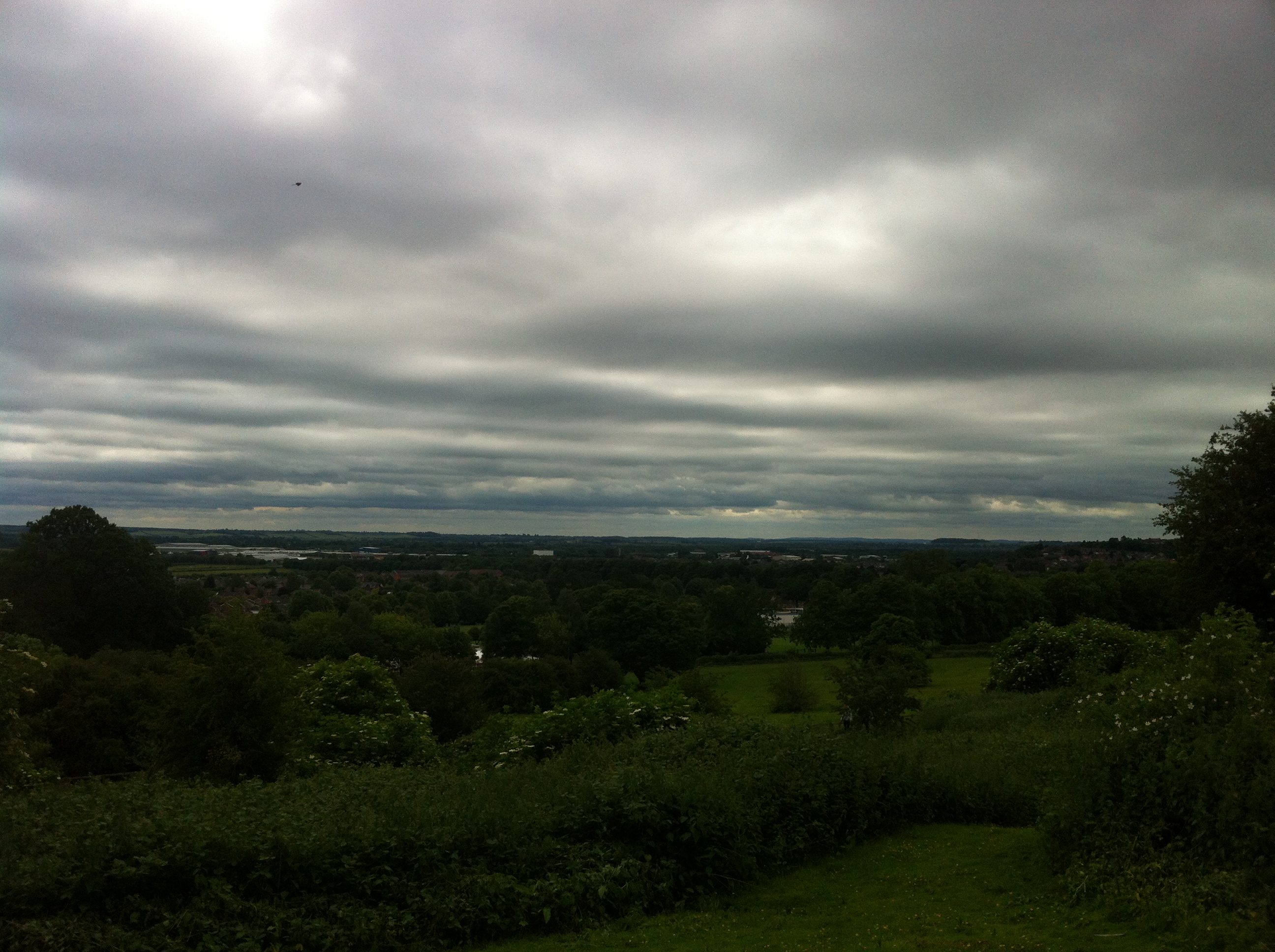
Gedling from on-high

The new Victoria Station in Nottingham (which is obviously now a big ugly shopping centre) rendered the route superseded, of course, the tunnel succumbing to subsidence didn’t help either – although the suburban network of tunnels that are now inaccessible replaced the route for a while.  I wish they’d open up all the tunnels for would-be explorers – the magnitude and ambition of their creation is phenomenal even by today’s standards, when you consider when they were built it becomes even more amazing.

Anyway, enough of my statto-like nonsense – it all started by going out for a walk, and I’ve taken in a degree of bird-watching, industrial reminisces and old railway routes.  I might as well get the anorak and leather-bound notebook right now, hadn’t I?  Having wandered more around the site of the colliery in the route to get up the hill, it’s amazing how little remains of what obviously was at one point a very heavily developed site with lots of infrastructure.  It is kinda nice to see nature gradually taking over, though!

I’ve uploaded more pictures to Facebook, and a funky panoramic thingamajig from the top of the hill which I really like 🙂

Categories: Blog, Exploring | 1 Comment

Blog at WordPress.com.